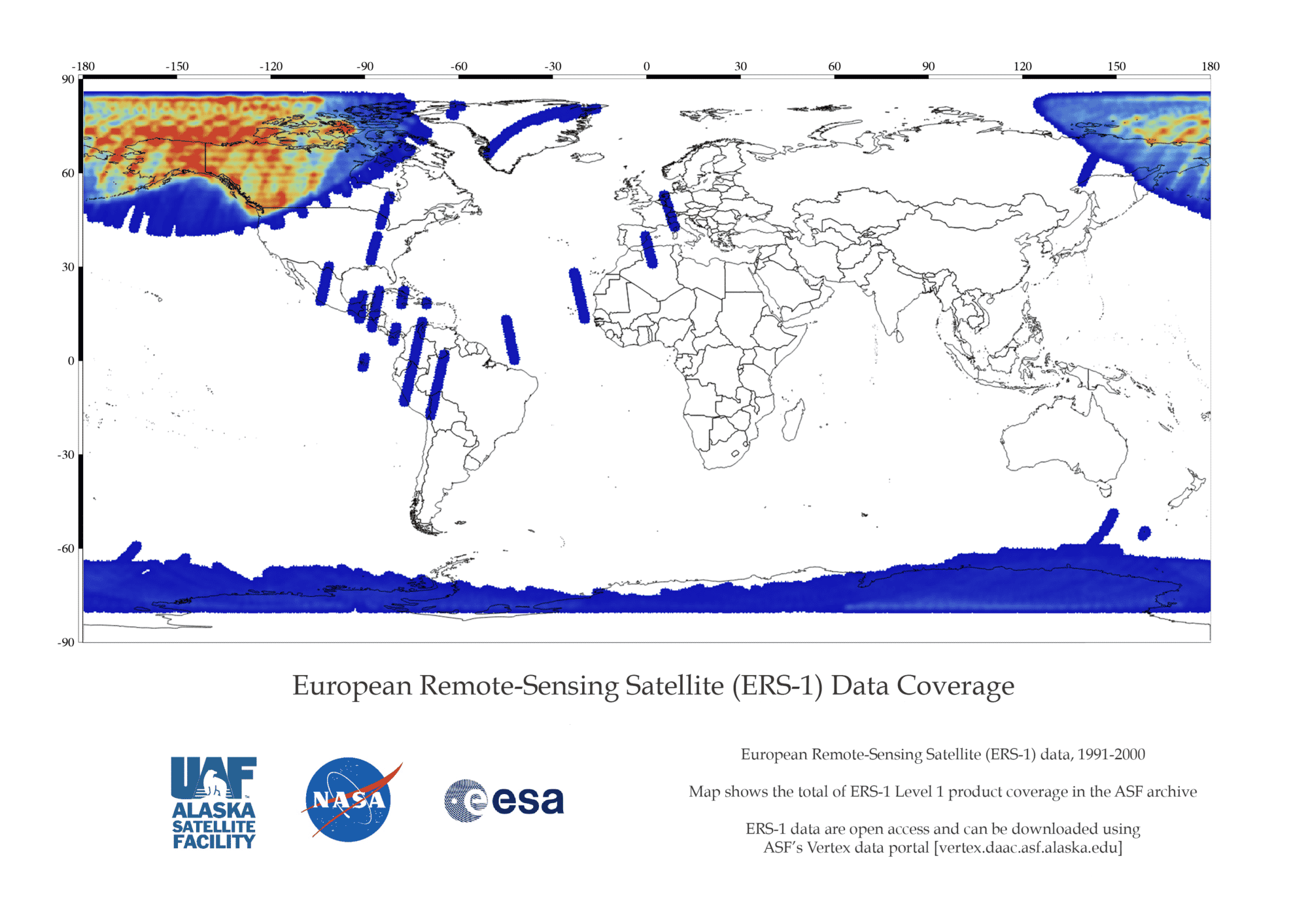
Alaska Satellite Facility - Distributed Active Archive Center

ERS-1

Artist renderings of ERS 1 and ERS 2 Satellites in space

NASA’s provision of the European Space Agency’s (ESA) European Remote Sensing satellites (ERS-1 and ERS–2) Synthetic Aperture Radar (SAR) data archive via the ASF DAAC is free and open by agreement between NASA and ESA. As part of the Earth observation Heritage Data Program (LTDP+), the ERS-1 and -2 missions provide scientists with historically accurate and easily accessible information to help further understand the dynamics of our planet.

ASF holds a subset of all ERS data.

NASA logo
European Space Agency logo

Overview

ERS- 1 primarily collected high resolution imagery within the ASF and the McMurdo, Antarctica, station masks. The datapool contains ASF standard beam odd frames, as well as the first and last frame of each imaged swath. ERS 1 flew in tandem with ERS-2 for 9 months in 1995/1996. Both sets of data are suitable for interferometry.

Click to read more on the ESA website

ERS-1 Dataset Summary

Dataset PropertyValue
Temporal Coverage1991 - 2000
Repeat Cycle35 days
Spatial CoveragePrimarily imagery within the ASF and the McMurdo, Antarctica, station masks
Center Frequency5.3 GHz/C-band 5.6 cm
PolarizationSingle Polarization (VV)
Spatial Resolution26 m in range (across track)
Between 6 m and 30 m in azimuth (along track)
Swath Width100 km
Off-Nadir Angle21°​
Download infoData Discovery
File formatCEOS
ProviderESA
Date published:1991

Expand the sections below to view content.  Access the full content on a single page by clicking the button.

The ERS-1 mission phases are listed below. For more information on each phase, see the Delft University of Technology website, which retrieved the information originally from ESA/ESRIN.

ERS 1 Coverage Map

ESA ERS 1 Data Coverage Map
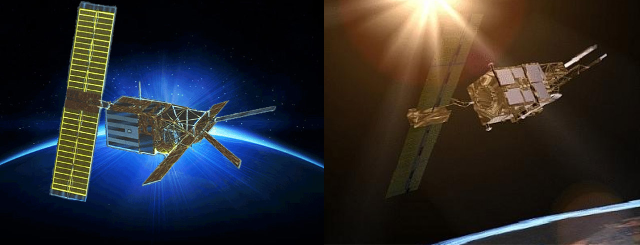
ERS 1 Coverage Map

ERS 1 Missions

The ERS-1 mission phases are listed below. For more information on each phase, see the Delft University of Technology website, which retrieved the information originally from ESA/ESRIN:

A. Commissioning Phase: 25-Jul-91 to 10-Dec-91

B. Ice Phase: 28-Dec-91 to 30-Mar-92

R. Roll Tilt Mode Campaign: 4-Apr-92 to 13-Apr-92

C. Multidisciplinary Phase: 14-Apr-92 to 21-Dec-93

D. Second Ice Phase: 23-Dec-93 to 10-Apr-94

E. First Geodetic Phase: 10-Apr-94 to 28-Sep-94

F. Second Geodetic Phase: 28-Sep-94 to 21-Mar-95

G. Tandem Phase: 21-Mar-95 to 5-Jun-96


ERS-1 Datasets and DOIs
DatasetDOI
L0_ERS-110.5067/GKOFAHGFBETY
L1_ERS-110.5067/M7502I707TVZ10.5067/M7502I707TVZ

Downloadable Products

Downloadable Products ERS-1:

Level 0 (unprocessed/raw data)

Level 1 (amplitude — processed images)

Citation information

ESA ERS-1 End User License Agreement

Data provided by the ERS-1 and ERS-2 missions are available in an open and non-discriminatory way, and distribution of the data shall be consistent with United Nations Resolution A/RES/41/65 dated 3 December 1986 on Principles Relating to Remote Sensing of the Earth from Space.

ESA does not guarantee the suitability of ERS-1 or ERS-2 data for the purpose of a project and shall not be held liable for any damage derived from the use of such data by the user.

The acceptance of these Terms and Conditions will authorize full access using Vertex to the ERS-1 and ERS-2 datasets at ASF DAAC.

I acknowledge and agree to respect the full title and ownership by ESA of all ERS-1 and ERS-2 data.

I agree to clearly mark all ERS-1 and ERS-2 data, irrespective of the form in which it is reproduced, in such a way that the data credit or image copyright are clear to see.

Data: Dataset: ERS-2[1], ESA [year of data acquisition]. Downloaded from ASF DAAC [day/month/year of data access].

Images: © ESA [year of data acquisition]


How to Cite ERS-1 Data Retrieved from ASF DAAC

Dataset ProductHow to CiteFormatExample
ERS 1 DataCite data in publications such as journal papers, articles, presentations, posters, and websites. Please send copies of, or links to, published works citing data, imagery, or tools accessed through ASF to [email protected] with “New Publication” on subject line.Dataset: ERS-2, ESA [year of data acquisition]. Retrieved from ASF DAAC [day month year of data access].Dataset: ERS-2, ESA 1993. Retrieved from ASF DAAC 7 December 2014.
ERS 1 ImageryInclude credit with each image shown in publications such as journal papers, articles, presentations, posters, and websites.© ESA [year of data acquisition]© ESA 1993

Discover ERS-1 Data

ERS-1 products can be accessed at ASF DAAC:


Data Discovery ToolLink
ASF Vertex Data SearchVertex
Python Search Moduleasf_search
ASF Search APIASF Search API
NASA Earthdata SearchEarthdata Search

Learn more about ASF Data Discovery Services