

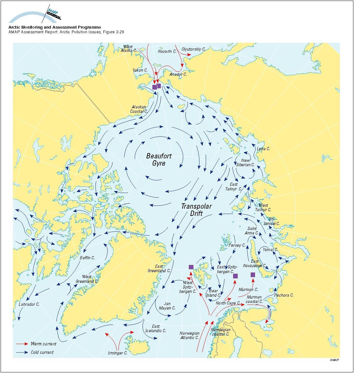
Drift ice is not frozen to anything stationary, such as a shore, the ocean bottom, or grounded ice. In the Arctic Ocean, where drift ice can move as much as 10 km a day, winds and currents tend to transport the floating ice in two patterns. The Beaufort Gyre moves in a clockwise rotation in the Beaufort Sea, and the Transpolar Drift Stream (see map), flows from the Arctic Ocean toward the Atlantic. As Arctic sea ice has thinned in recent decades, its drift speed has tended to increase.
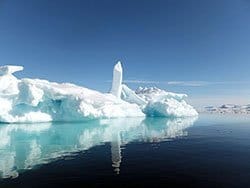
Fast ice, sometimes called landfast ice, freezes to the shore, the ocean bottom, an ice wall, or a grounded iceberg. If it rises more than about two meters above sea level, it is called an ice shelf.
First-year sea ice has lasted for no more than one winter, but it is thicker than the thin films of new ice called frazil, grease ice, and nilas. Although first-year ice ejects salt from its ice crystals in the freezing process, it still contains pockets of saltwater. If first-year ice survives to become multiyear ice, the saltwater eventually drains out, and the ice becomes denser. As Arctic sea ice has diminished in recent decades, first-year ice has become more prevalent than multiyear ice.
Sea-ice floes are individual pieces of sea ice 20 m or more across.
Frazil is the start of sea ice — a collection of ice crystals that form a film on the water. As the crystals form, they eject salt into the surrounding water. The saltier the water, the heavier it is, so it sinks. The ocean becomes layered with sea ice on top of cold water, on top of heavier, saltier water. Those layers move in currents around the world, playing a large role in global climate.
Grease ice is the next stage after frazil, when the ice crystals assemble in a syrupy layer.
Ice shelves are landfast sea ice (also known as fast ice) that rise more than about two meters above sea level.
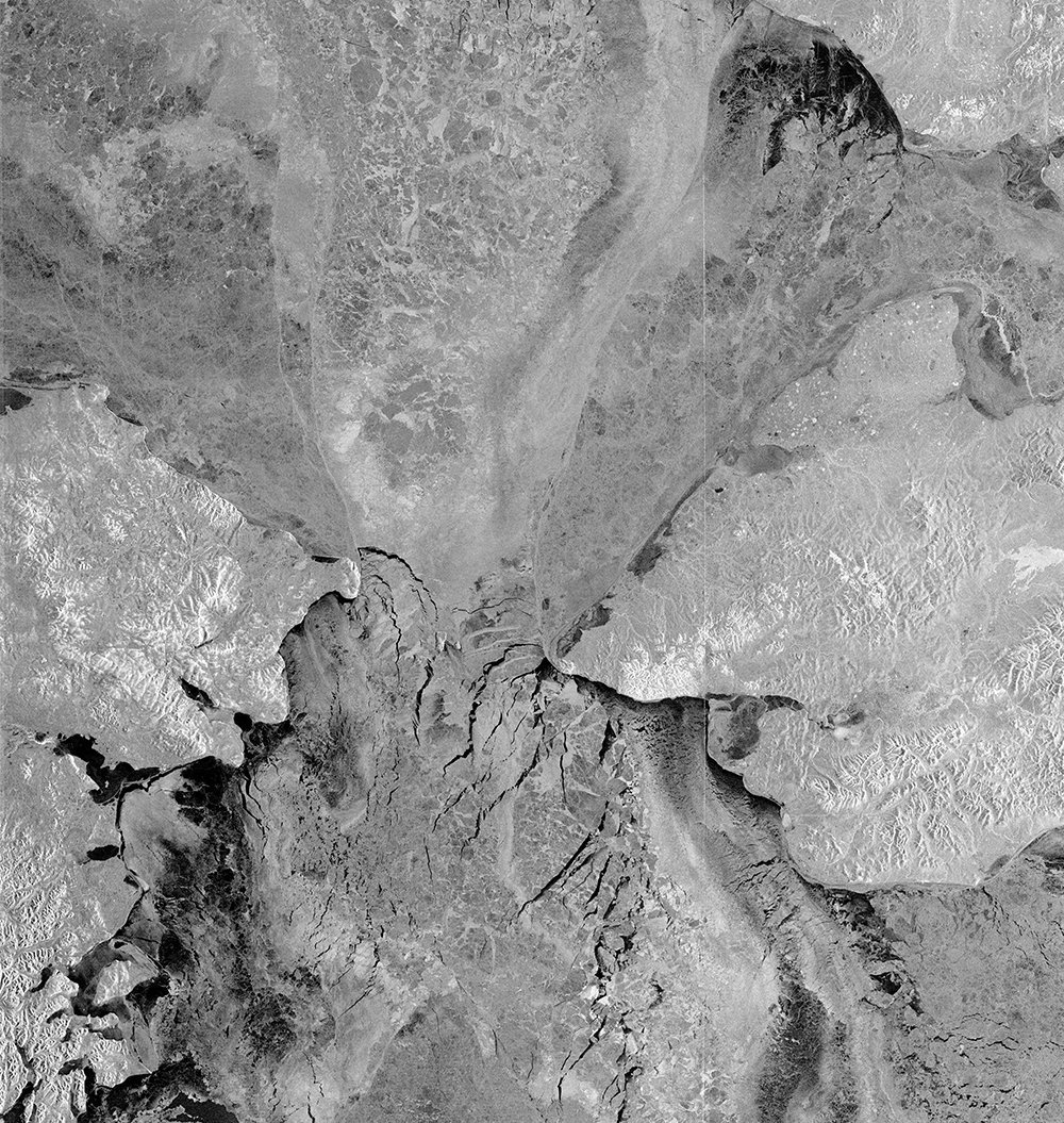
Lagrangian sea-ice data products contain monthly measurements of dynamic and kinematic parameters over the Arctic Ocean sea-ice cover. “Lagrangian” refers to a mathematical way to study ice dynamics by noting changes in position and velocity of points over time. The sea-ice analysis in the dataset available here is initialized by laying a 10km-by-10km grid over a set of RADARSAT-1 images of the sea ice during an initial 3-day period of a season. The grid forms cells for which a number of properties can be derived that describe the sea-ice dynamics. The grid points of the sea ice and related cell properties are then tracked throughout the season.
Leads are long, linear areas of open water that develop as sea ice pulls apart, moved by winds or currents. A lead in sea ice can range from a few meters to over a kilometer in width and tens of kilometers long. Leads and polynyas (see below) are important for wildlife. The world’s population of spectacled eiders, for example, spends each winter in the northern Bering Sea, depending on the water in leads and polynyas when most other open water is frozen.
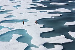
Sea ice melt ponds form in depressions on top of the ice, deepening them. Because ice serves as a reflective surface that absorbs little solar energy, the darker water of melt ponds significantly warms both the ice and the atmosphere, accelerating the melting.
Multi-year sea ice has survived at least two summers. Unlike first-year ice, multi-year sea ice is almost free of salt. In recent years, multi-year sea ice has become thinner.
Pack ice is a term sometimes used to refer to particularly closely packed sea ice. It is sometimes used interchangeably with drift ice (see above).
Pancake ice consists of flat, circular pieces of sea ice that form from frazil and/or grease ice in rough water. They also can form below the surface. The edges of the “pancakes” are characteristically thickened from colliding in winds, waves, or currents in a sort of bumper-car effect.
Polynyas, like leads (see above), are large open areas of water surrounded by sea ice — or by sea ice on one side and land on the other. Polynyas, however, are wide, not long and narrow. Polynyas and leads are important for wildlife.
Sea-ice pressure ridges form when wind and currents press ice against sea ice, causing the sea ice to buckle and/or layer on top of itself.
Rafting takes place when winds or currents push pieces of sea ice on top of each other.
The RADARSAT-1 Geophysical Processor System (RGPS) was designed to analyze the large volumes of SAR imagery required to produce basin-wide fields of sea-ice motion and estimates of sea-ice age and thickness from sequential RADARSAT-1 maps of the Arctic and Southern Oceans. From the RGPS, researchers have been able to obtain routine estimates of the seasonal sea ice produced by deformation of the sea-ice cover.
