

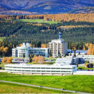
Simon Zwieback’s office has little space in which to maneuver on this particular day in the West Ridge Research Building at the University of Alaska Fairbanks. Boxes of equipment and supplies dot the floor in preparation for a research trip to the far north in Alaska.
It will be the first of three visits the assistant professor will make to Toolik Field Station for a project to determine areas that have ice-rich permafrost.
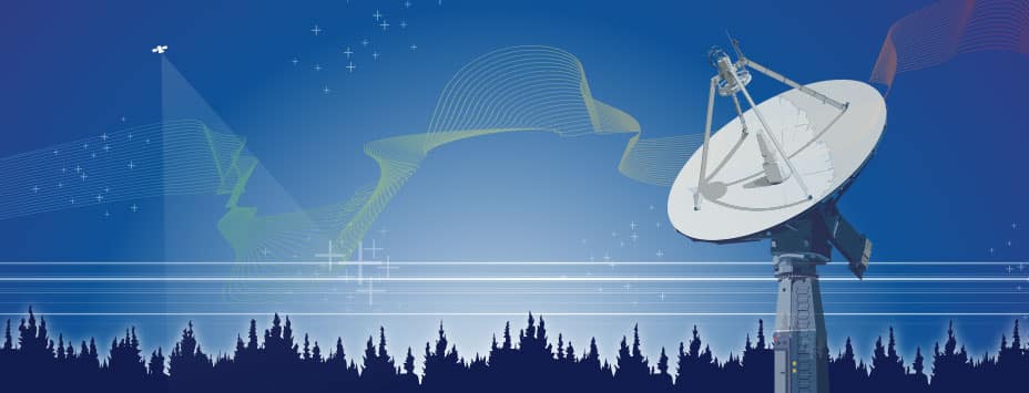
The project draws on data from the European Space Agency’s Sentinel-1 satellite constellation and downlinked and made available through the Alaska Satellite Facility, which operates as one of 12 NASA Distributed Active Archive Centers.
“It’s important because if that ice melts due to warming or disturbances, that can cause the surface to become unstable,” he said. “That causes all those hazards that we’re familiar with. If you’ve ever driven on a road in or around Fairbanks, you know about that.”
“The Alaska Satellite Facility is critical for this work because we’re using the data that is hosted here,” he said.
The project combines two of his passions: remote sensing and permafrost.
•••
Simon was born and raised in Mödling, Austria, a community now of about 20,000 people about 15 miles south of Vienna. The city lies in the country’s northeast and is the gateway to the Brühl Valley.
When did he develop his interest in science? At an early age.
“It was a gradual process,” he said. “I did not have an epiphany or eureka moment. I have always been interested in nature and in technology.
“My interests growing up were pretty broad. I was not obsessed about specific things. I guess I collected fossils, rocks and minerals when I was 4 to 6 years old, come to think of it.”
The “gradual process” that perhaps began with his childhood interest in science eventually led to a Ph.D. in environmental engineering from the prestigious research university ETH Zurich in Switzerland in 2016. Twenty-one Nobel Prize winners have an association with the university, which focuses on science, technology, engineering and mathematics.
Simon earlier obtained his Master of Science in geodesy and geophysics from Vienna University of Technology, Austria, in 2011 and his Bachelor of Science in geodesy and geoinformation from that university in 2009.
With his formal education complete, Simon’s professional career began.
He has been an assistant professor at UAF since 2021. He was a research associate at UAF from 2019 to 2020.
“My Ph.D. wasn’t directly related to permafrost. However, during my master’s, I was working on permafrost-related questions,” he said. “Toward the end of my Ph.D. I was sucked back into this. And then I moved to Canada to do my postdoc and did a lot of fieldwork in Arctic Canada.
“It was not entirely unnatural for me to then come here to Fairbanks.”
Prior to arriving at UAF, Simon was a Swiss National Science Foundation fellow at the University of Guelph, in Ontario, Canada, from 2017 to 2019 and a postdoctoral research associate in 2016-2017 at ETH Zurich. He was a research assistant at Vienna University of Technology in 2011.
•••
Remote sensing and the Alaska Satellite Facility are key for a major research undertaking: a close look at some little-noticed yet significant impact from the 2015 catastrophic flooding of the Sagavanirktok River in northern Alaska. The flooding shut down a 10-mile stretch of the vital Dalton Highway for about two weeks.
Water and slush flooded numerous locations along the highway. The state Department of Transportation and Public Facilities built up roadside snow berms to hold back the water, but the barriers failed.
Unexpectedly early post-winter warming caused the flooding, which covered the surrounding flat and treeless landscape with water and slush.
Simon is leading a study to measure the resulting change in the landscape.
“It flooded areas that are very rarely inundated,” he said. “We don’t have a good estimate of how rare the flood was because we lack long-term data. But it was clear that a lot of tundra areas that usually aren’t flooded were inundated.”
The flooding had immediate and obvious consequences, melting the underground ice and thereby causing parts of the tundra to collapse within a few hours. That impact has been previously studied.
Simon’s work through remote sensing is looking at the lesser-known and subtle long-term changes the flooding brought to the region.
“Remote sensing is crucial, because it provides us with this synoptic view of the entire landscape,” he said.
Data held by ASF provided a supporting role in that research, mainly through data about the extent of the flooding. Information from the Japan Aerospace Exploration Agency’s ALOS-2 satellite is the primary data source.
•••
Among his many research papers, one that stands out for Simon is one produced with colleague Franz Meyer of the UAF Geophysical Institute’s Remote Sensing Group.
That paper, titled “Reliable InSAR Phase History Uncertainty Estimates,” used data from ASF and is useful for the value-added products that the Alaska Satellite Facility is increasingly involved in, Simon said.
“It’s about making InSAR deformation products more reliable,” he said. “Having good knowledge of the errors is important for decision making and integration with models.”
That work is just another example of the power remote sensing and the important role of the Alaska Satellite Facility.
“The public benefits from the results that research agencies as well as commercial enterprises obtain from the data that ASF provides,” he said. “They won’t use those data directly, but they will benefit from what the users of the ASF produce.”
“Examples include flood mapping for the response to disasters,” he said. “And mapping for long-term planning.”