RAMP Data Interface
Articles from NASA: Mosaic of Antarctica | RAMPing Up
Data Interface FAQ
This interface allows users to download RAMP data either piecemeal, or using a metalink file.
You can download the remote sensing data products generated from the AMM-1 or MAMM missions.
Below the preview image, there are dropdowns for the Mission, Product Type, and Product. The dropdowns and preview image will change as you select from the dropdowns.

When you select an individual data product, a preview window will open giving you the options to close it (X), Download Now, or Add to List. You can use the Download Now option to download it immediately, or you can add it to the “Selected Items” list to download with a group via Metalink.
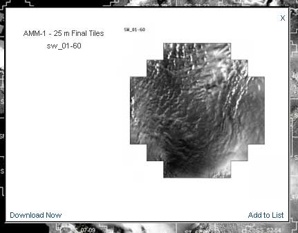
Click on the Label or ‘*’ for the tile.
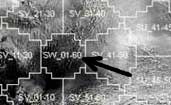
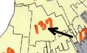

Click on the “Add all Tiles to Queue” link at the bottom left of the preview image after navigating to the desired tile product.

After navigating to the desired product, Click on either the “Download [desired data product]” to download immediately, or “Add [desired data product] to Queue” to add to the selected items list for bulk download.

The Selected Items list on the right side of the interface allows you to preview and modify the data products you are adding to your Bulk Download.

You can download the remote sensing data products generated from the AMM-1 or MAMM missions.

Click on the ‘x’ next to the item that you do not want on the list. (you may have to use the the bottom scroller to see the Xs)

Click the “Clear all items” button at the bottom of the list.
Click the “Download all items” button at the bottom of the list.
Mini-MAMM Products
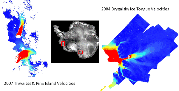
After the two initial RAMP missions, AMM-1 and MAMM, two mini-MAMMs occurred from September to December in 2004 and 2007 in order to gather ice velocity data for Drygalski Ice Tongue and Thwaites and Pine Island Glaciers.
Above are animations showing motion along Drygalski Ice Tongue and David Glacier from MAMM cycle 1 and 3.
2004 Drygalski Mosaic 100 m
2004 Drygalski header file
2007 Drygalski Mosaic 100 m
2007 Drygalski header file
2004 Thwaites/Pine Isle Mosaic 100 m
2004 Thwaites/Pine Isle header file
2007 Thwaites/Pine Isle Mosaic 100 m
2007 Thwaites/Pine Isle header file
2004 Drygalski Mosaic 100 m
2004 Drygalski header file
2007 Drygalski Mosaic 100 m
2007 Drygalski header file
2004 Thwaites/Pine Isle Mosaic 100 m
2004 Thwaites/Pine Isle header file
2007 Thwaites/Pine Isle Mosaic 100 m
2007 Thwaites/Pine Isle header file
2004 Drygalski Mosaic 100 m
2004 Drygalski RRD file
2007 Drygalski Mosaic 100 m
2007 Drygalski RRD file
2004 Thwaites/Pine Isle Mosaic 100 m
2004 Thwaites/Pine Isle RRD file
2007 Thwaites/Pine Isle Mosaic 100 m
2007 Thwaites/Pine Isle RRD file
Instructions for creating an ARC shape file and plotting arrows in ARCMap
2004 Drygalski Velocities (X, Y, mag, vx, vy, angles)
2007 Drygalski Velocities (X, Y, mag, vx, vy, angles)
2004 Thwaites/Pine Isle Velocities (X, Y, mag, vx, vy, angles)
2007 Thwaites/Pine Isle Velocities (X, Y, mag, vx, vy, angles)
Velocity Documents
In order to capture the diverse velocity field of the Thwaites and Pine Island Glaciers (years 2004 and 2007) multiple sets of RAMS Vphase parameters had to be used, resulting in multiple sets of overviews (ov_## files listed below). Each overview was edited for any erroneous velocity vectors and concatenated into a final product.
A detailed description of all the RAMS VphaseTool Phase I parameters (registration and creation of interferograms) was provided by the Vexcel Corporation, the developers of RAMS, and is available in addendum III of the BPRC Tech Report.
In the creation of the interferograms, the three prominent parameters used for estimating a range of velocities are the 1) lower coherence threshold, 2) offset chip size and 3) offset search radius, all other default parameters were used. A description of the ‘optimum’ search radius and chip sizes is included below (‘Optimal Search Radius and Chip Size’ link).
README File
Readme file associated with each *.tar file. Please read to familiarize yourself with the contents of each file.
Location of the Thwaites and Pine Island overviews (ov_*) for years 2004 and 2007 Shows the location of each of the ov* files that made up the concatenated Final Velocity ASCII file (if more than one).
Optimal Search Radius and Chip Size
Note: A chart of Search Radius and Chip Size parameters for individual overviews is forthcoming.
RAMS Final Velocity Products
Thwaites and Pine Island 2004
ov_01tpi04
ov_02tpi04
ov_03tpi04
ov_04tpi04
ov_05tpi04
ov_06tpi04
ov_07tpi04
Other RAMP Products
Mosaic
RAMP 1997 200 m mosaic (version 2)
Text Files
Liu and Jezek 1997 Coastline: arc export file
Jezek and Sohn AMM-1 Flow Stripes and Shear Margins: arc export file (see Wu and Jezek, 2005) File 1, File 2, File 3
Flow Lines from RAMP DEM (Liu, Jezek, and Li)
Ice Divide From RAMP DEM (Liu, Jezek and Li)
Historical Mosaics
1963 DISP Image Mosaic of Coastal Antarctica
1963 Antarctic Header File
Historical Papers
Kim, Jezek and Liu Antarctic DISP Paper


