

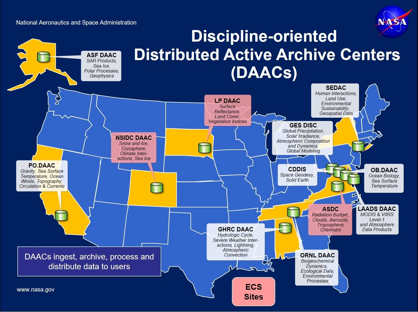
The National Aeronautics and Space Administration (NASA) Earth Science Data and Information System (ESDIS) Project is a part of the Earth Science Projects Division under the Flight Projects Directorate at Goddard Space Flight Center. As key components of ESDIS, 12 interlinked Distributed Active Archive Centers (DAAC) are operated by a distributed network of independent facilities across the United States — including the NASA DAAC operated by the Alaska Satellite Facility (ASF).
The ASF DAAC specializes in synthetic aperture radar (SAR) data collection, processing, archiving, and distribution. These data are or have been, supplied by SAR sensors on many different spaceborne and airborne platforms, including:
- European Space Agency’s Sentinel-1, European Remote Sensing Satellite (ERS)-1, and ERS-2
- Japan Aerospace Exploration Agency’s Japanese Earth Resources Satellite (JERS-1) and Advanced Land Observing Satellite (ALOS)
- Canadian Space Agency’s RADARSAT-1 Satellite
- NASA’s SMAP, Airborne Synthetic Aperture Radar (AIRSAR), Uninhabited Aerial Vehicle Synthetic Aperture Radar (UAVSAR), SIR-C, and Seasat missions.
User Working Group
The ASF DAAC has a User Working Group (UWG) of scientists from the fields of research that the ASF DAAC serves.
A formal Charter has not been written for the UWG. The UWG operates under the following terms of reference.
- Reviewing the progress and performance of the DAAC relative to the ASF DAAC’s missions
- Representing the user community in the development and operation of the ASF DAAC products and services
- Suggesting specific data products and services to NASA and the ASF DAAC
- Providing input to NASA and ASF on the ASF DAAC objectives, priorities, target user communities, implementation approaches, and other issues
Get SAR Data
ASF Vertex Data Search
Note: Newcomers to ASF DAAC data may want to refer to the Get Started page.
ASF has developed and deployed a user interface to highlight the contents of the pre-processed ASF DAAC SAR data pool. Vertex is an intuitive user interface that facilitates the search for and visualization of ASF DAAC data pool assets, delivery of relevant metadata about those assets, and bulk delivery of those ASF data. Vertex is designed to familiarize users with SAR data without requiring any prior knowledge of SAR platforms, beam modes, or processing parameters.
ASF Search API
The ASF Search API is an application programming interface that enables command-line search and download.
