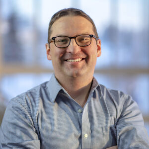


Headlines

On-Demand Sentinel-1 RTC processing and ArcGIS Toolbox are now available from ASF
Sentinel-1 radiometric terrain correction (RTC) can now be ordered through the ASF Vertex Data Search portal. RTC removes distortions inherent in SAR images and provides analysis-ready data. The ASF ArcGIS Toolbox provides tools that facilitate the use of RTC products for geospatial analysis.

Two Part SAR Webinar: Part 1- Introduction to Synthetic Aperture Radar (SAR) Data
Part 1 of a webinar hosted by GIS specialist, Heidi Kristenson, which includes a basic introduction to SAR data collection, the datasets that are available from the ASF DAAC, and the processing required to extract useful information from the data.

Two-Part SAR Webinar: Part 2- Applications of SAR Data in GIS Environments
Part 2 of a webinar hosted by GIS specialist, Heidi Kristenson, which focuses on Sentinel-1 datasets, discussing options for generating Radiometric Terrain Corrected (RTC) datasets, and present workflows using both ArcGIS and QGIS software.

ALOS AVNIR-2 Data Now Available
Need optical data? ALOS AVNIR-2 Ortho Rectified Image products created by JAXA (Japan Aerospace Exploration Agency) are now available from the ASF DAAC as a result of partnership between NASA and JAXA.
Training and Resources
Synthetic Aperture Radar: Hazards
This six-week edX course teaches the fundamentals of the use of Synthetic Aperture Radar (SAR) remote sensing for disaster monitoring. The course is FREE, with the option to pursue a Verified Certificate. Information online
ESA Sentinel Online (Sentinel-1)
Sentinel-1 Mission Guide
SAR Data How-To
Data Recipes To Make Using SAR Data Easier
SAR Scientist Highlight

JAN 2021 - LJ Evans
Paul Rosen, PhD
Dr. Paul Rosen is Project Scientist for the NASA-ISRO SAR (NISAR) mission. NISAR will measure Earth’s changing ecosystems, dynamic land surfaces, and ice masses, providing critical measurements for carbon cycle modeling, natural hazards research, sea level rise, groundwater exploitation, and more. With its all-weather, day/night, multi-frequency, polarimetric capability, NISAR will also support a host of other applications.
Dr. Rosen is applying 35 years of experience in Earth and planetary radar remote sensing to guiding NISAR science and the potential benefits and impact of these data in the science and applications community. This entails interacting with scientists, engineers, managers, and the public, at all levels and in many capacities. He expects NISAR to have a major impact on how science and applications are developed using synthetic aperture radar (SAR) data, noting that NISAR will provide the world with an unprecedented source of data, processing tools, and educational materials. NASA’s Alaska Satellite Facility Distributed Active Archive Center (ASF DAAC) will take a leading role in NISAR data distribution and education.