





About the Alaska Satellite Facility
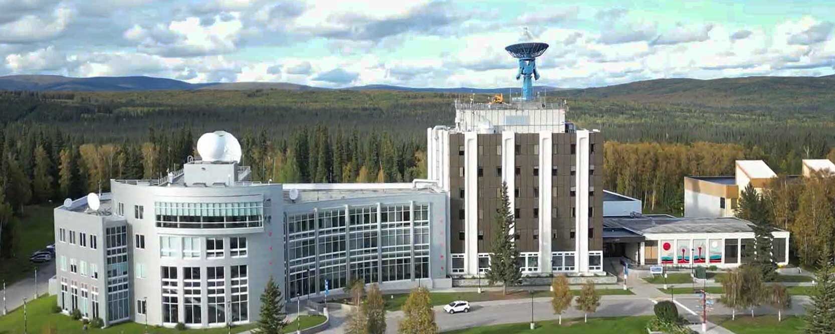
The Alaska Satellite Facility (ASF), located at the Geophysical Institute (GI) of the University of Alaska Fairbanks (UAF), supports Earth science research by providing reliable access to high-quality data and tools. ASF empowers scientists, researchers, and field teams around the world to explore and better understand dynamic Earth systems through the use of Synthetic Aperture Radar (SAR) data. As the NASA SAR Distributed Active Archive Center (DAAC), ASF plays a key role in managing and distributing SAR data. ASF operates two ground stations in Fairbanks, one as part of the NASA Near Space Network (NSN) and the other within the Viasat Real-Time Earth (RTE) global satellite communications network; both of which are essential for acquiring satellite data used in near-real-time applications and long-term scientific research.- Impact
- History
- Leadership
- Join Us!
Our Mission
Making Remote-Sensing Data Accessible
Through data acquisition, processing, archiving, and global distribution, ASF delivers the resources researchers need to drive innovation and advance scientific discovery across disciplines.
Our Impact
ASF serves a diverse global community of scientists and data users by supporting critical climate and environmental research, including studies of glacier dynamics, sea ice monitoring, and ecosystem change. The facility plays a key role in enabling rapid disaster response by providing timely radar data during events such as earthquakes, floods, and volcanic eruptions.
By offering open-access SAR data and user-friendly tools, ASF helps accelerate scientific discovery and foster collaboration across disciplines. ASF helps push the boundaries of what’s possible in Earth observation by working closely with the research community to explore new ideas and applications, and by providing comprehensive training, detailed documentation, and dedicated user support to ensure they can fully harness the power of SAR data in their work.
Our Commitment
ASF’s commitment to advancing Earth science is grounded in accessibility, data integrity, and service to the research community.

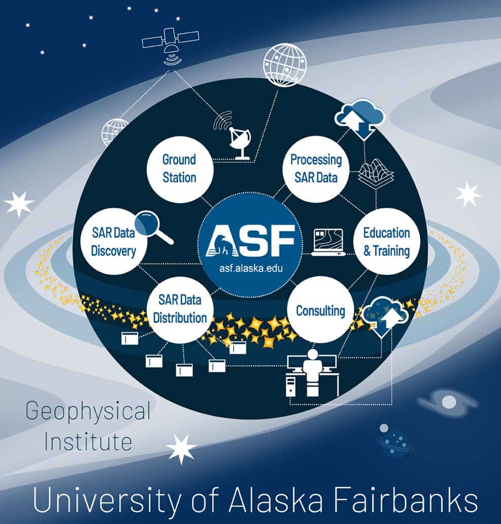
ASF’s array of services as part of the Geophysical Institute and the University of Alaska in Fairbanks.
ASF History
ASF was established in 1991 on the UAF campus. However, its roots trace back to earlier satellite and Earth science initiatives in the 1980s. The motivation for its creation stemmed from the need for a high-latitude ground station capable of receiving data from polar-orbiting satellites. Given Alaska’s geographic position, Fairbanks offered a unique strategic advantage – allowing communication with satellites during nearly every orbit. Created as part of a collaboration between the University of Alaska, NASA, and the National Oceanic and Atmospheric Administration (NOAA), ASF was initially known as the Alaska SAR Facility, which reflected its early focus on SAR data – a remote sensing technique particularly useful in Alaska’s often cloud-covered and often dark environments. Today ASF operates as part of the Geophysical Institute at UAF and remains a key component of NASA’s Space Communications network and its Earth Science infrastructure. Its mission focuses on making SAR data accessible to support scientific research, resource management, and disaster response.
ASF Leadership

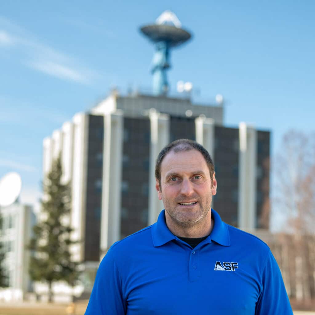
Wade Albright
Director, Alaska Satellite Facility
Paul Austin
ASF Ground Station Manager

Ian Dixon
ASF Engineering Manager

Kirk Hogenson
ASF Product Development Manager

Franz Meyer
ASF Chief Scientist

Suzy Nicolai
ASF Executive Business Manager
Be a part of the ASF team!
Apply for University of Alaska career employment opportunities at ASF through the UA Careers website.
Computer Science and Engineering students will find a rich, inclusive, and supportive environment offering real-world experience in a NASA-affiliated organization. Interested? Contact us at [email protected].
UA is an AA/EO employer and educational institution and prohibits illegal discrimination against any individual.
Planning to visit ASF?
Campus Map
Driving Directions
Campus Map
Directions from Fairbanks International Airport to the Alaska Satellite Facility, West Ridge Research Building.
Download Campus Map.
Driving Directions
Directions from Fairbanks International Airport to the Alaska Satellite Facility, West Ridge Research Building:
- Take AIRPORT WAY NORTHEAST from the airport. If you depart from the rental car parking lot at the airport, the exit will funnel you onto AIRPORT WAY. If you depart from in front of the terminal, bear left at the first intersection, bear right at the second intersection, and you will end up on AIRPORT WAY.
- Merge onto the southbound entrance, via the ramp on the left, to the ROBERT MITCHELL EXPRESSWAY/AK-3 S/INTERSTATE A3, toward Denali National Park/Nenana.
- Take the GEIST RD/CHENA PUMP RD exit.
- Turn RIGHT onto GEIST RD, get into the LEFT land (you have time to do this).
- Turn LEFT onto THOMPSON DRIVE at the stop light. Continue straight until you reach the traffic circle.
- Take second RIGHT from the traffic circle up the obvious hill (Tanana Loop Road). Continue straight on Tanana Loop Road. At the very top of the hill, there is a ski hut (it‘ll be on your left).
- Turn LEFT onto the road after the ski hut. The Akasofu building will be on your right. This road takes you to the PARKING LOT behind the Akasofu building and the West Ridge Research Building (WRRB). This parking lot is a UAF Parking Decal Required lot, with a kiosk that dispenses parking permits for a fee. PLEASE DO NOT PARK IN RESERVED SPOTS.
- Enter the WRRB entrance. Bear LEFT after entering the building, then go straight down the hallway. The Alaska Satellite Facility main administrative offices are in the WRRB, suite 105.