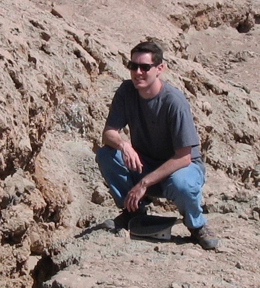
For Matthew Pritchard, volcanoes are where the action is. The more of them he can study, the happier he is.
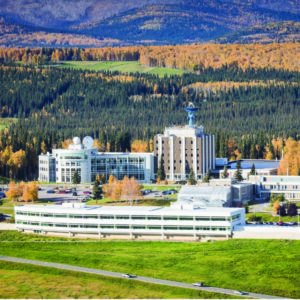
The Alaska Satellite Facility at the University of Alaska Fairbanks has been essential to that happiness.
In the early years of his research, the range of the satellite facility’s download mask allowed him to study volcanoes in Russia’s Kamchatka Peninsula. But his research opportunities expanded greatly when the facility began obtaining data from a Japanese satellite under an arrangement funded by NASA, the National Science Foundation and the National Oceanic and Atmospheric Administration.
“That gave us the whole Western Hemisphere,” he said, “and we were really able to use that data to look at a bunch of volcanoes in southern Chile, for example, and in other places that we hadn’t been able to see before.”
“That was a huge innovation,” he said.
Matthew, a professor of Earth and atmospheric science at Cornell University, has been involved with interferometric synthetic aperture radar since he was a graduate student at the California Institute of Technology more than two decades ago.
“And, you know, ASF has been there every step of the way, primarily providing access to data that we wouldn’t otherwise get,” he said.
His interest in science goes back much further, however, back to when he was a small boy living on the family farm about an hour out of Chicago and participating in the local 4-H club.
“I had a rock collection and sort of just never lost interest in science and kept going,” he said. “I majored in physics in college and then learned about InSAR (interferometric synthetic aperture radar) and remote sensing while I was a graduate student at Caltech.”
“And that’s where I really came into using InSAR and studying volcanoes. It’s really just been a passion of mine ever since,” he said.
Matthew earned a bachelor’s degree in physics from the University of Chicago, a master’s in geophysics from Caltech in 2000 and his Ph.D in geophysics, with a minor in planetary science, from Caltech in 2003. In 2005 he joined Cornell, where he is director of Graduate Studies for the Field of Geological Sciences and director of the Institute for the Study of the Continents.
Matthew is also president-elect of the American Geophysical Union’s geodesy section and will serve from 2023 to 2024 as president. He is also a member of the steering committee for the National Science Foundation Research Coordination Network: Community Network for Volcanic Eruption Response.
He is also the U.S. delegate to the International Association of Geodesy and previously served on numerous other academic, science and professional committees and boards.
His research areas include earthquakes, glaciers, interferometric synthetic aperture radar, tectonics, volcanoes.
Volcanoes are his love, however.
Matthew’s current research includes surveying the hundreds of volcanoes in the central and southern Andes for deformation, thermal anomalies, and seismic activity, characterizing the global patterns of volcano deformation and defining the magma and geothermal resources of the Western United States.
The numerous academic papers on which he worked include some made possible through the capabilities of the Alaska Satellite Facility. Matthew points to a 2010 paper by UAF graduate and Cornell postdoctoral researcher Tom Fournier, and on which Matthew is a coauthor, titled, “The duration, magnitude, and frequency of subaerial volcano deformation events: New InSAR results from Latin America and a global synthesis.”
“That was the first paper where Tom systematically looked at Advanced Land Observing Satellite data from the Japan Aerospace Exploration Agency (JAXA) hosted through ASF for all the volcanoes in Latin America just to figure out which ones were doing something that we didn’t know about or that had eruptions that we could say something about,” he said. “And it was really amazing that we could do that. It was only enabled because ASF had made the ALOS data available with support from JAXA and the government agencies.”
He also points to a 2019 paper: “Thermal, deformation and degassing remote sensing time series (A.D. 2000-2017) at the 47 most active volcanoes in Latin America: Implications for Volcanic Systems.” That paper included work by Franz Meyer of the Alaska Satellite Facility and Taryn Lopez, a research assistant professor at the UAF Geophysical Institute.
“We teamed up with a bunch of people who were experts in other types of satellite data, whether it be looking at satellite thermal data, measuring the temperatures of volcanoes, or measuring the gas emissions, in particular sulfur dioxide that was coming off the volcano,” Matthew said.
The result: A finding that volcano behavior can change and that it can all be measured by satellite and that the data can potentially be useful in forecasting eruptions.
“And that’s really an exciting thing,” he said. “Now we’re working on a project to move beyond Latin America and see how generalizable these are to global studies.”
Matthew’s volcano research will likely get a boost in a few years when a rocket carries the NISAR satellite into orbit in 2023 and a flood of data starts pouring into the Alaska Satellite Facility, chosen by NASA to host the satellite’s enormous amount of data.
He was involved for many years in preparations for NISAR, a U.S.-India satellite mission.
“My main involvement was in the transition from what was originally conceived as a mission called DESDynI as part of the 2007 decadal survey,” he said. “And as it turned into NISAR I was involved in both the solid earth and the cryosphere groups to help figure out the mission requirements in terms of the observations.”
“There are a lot of satellites up there, but they’re not really optimized yet for volcanoes,” he said. “So NISAR will be a great addition.”


