

AIRSAR
Table of contents
Add a header to begin generating the table of contents
AIRSAR Technical Specs
| Dataset Property | P-Band | L-Band | C-Band |
|---|---|---|---|
| Temporal Coverage | 1988-2004 | 1988-2004 | 1988-2004 |
| Spatial Coverage | Worldwide mission-specific sites | Worldwide mission-specific sites | Worldwide mission-specific sites |
| Frequency/Wavelength | 0.45 GHz/67 cm | 1.26 GHz/23 cm | 5.31 GHz/5.7 cm |
| Polarization | Full | Full | Full |
| Range Resolution | 7.5 m | 3.75 m | 1.875 m |
| Swath Width | 10 km | 10 km | 10 km |
| Off-Nadir Angle | 20-60° | 20-60° | 20-60° |
| File Format | AIRSAR (proprietary), JPG | AIRSAR (proprietary), JPG | AIRSAR (proprietary), JPG |
| Download Information | Data Discovery | Data Discovery | Data Discovery |
| Date Published | 1988-2004 | 1988-2004 | 1988-2004 |
Coverage Maps
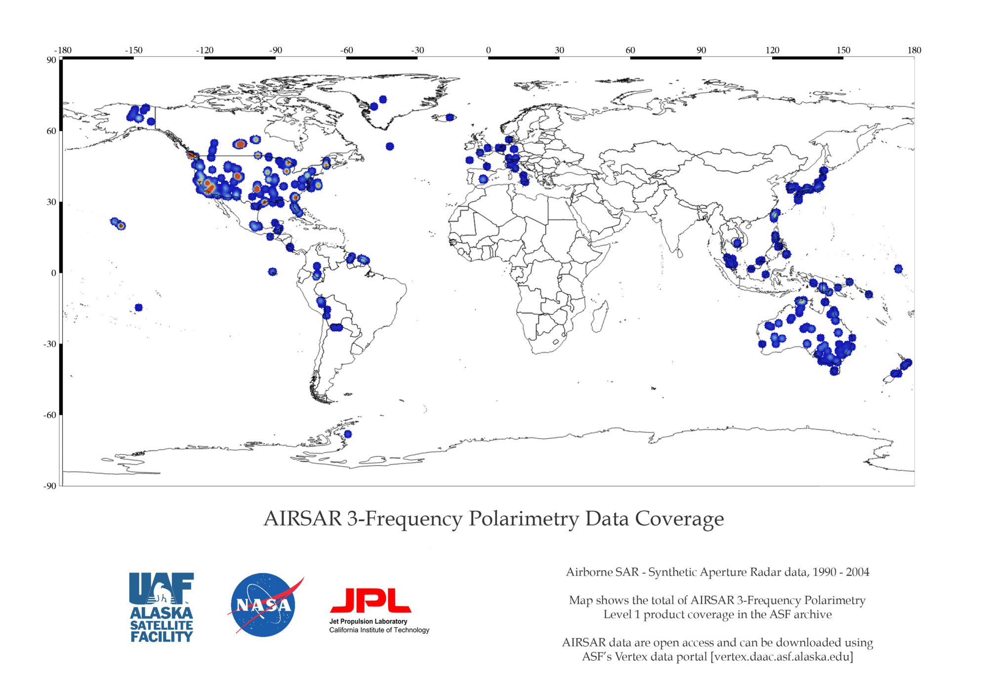
AIRSAR 3FP Coverage Map
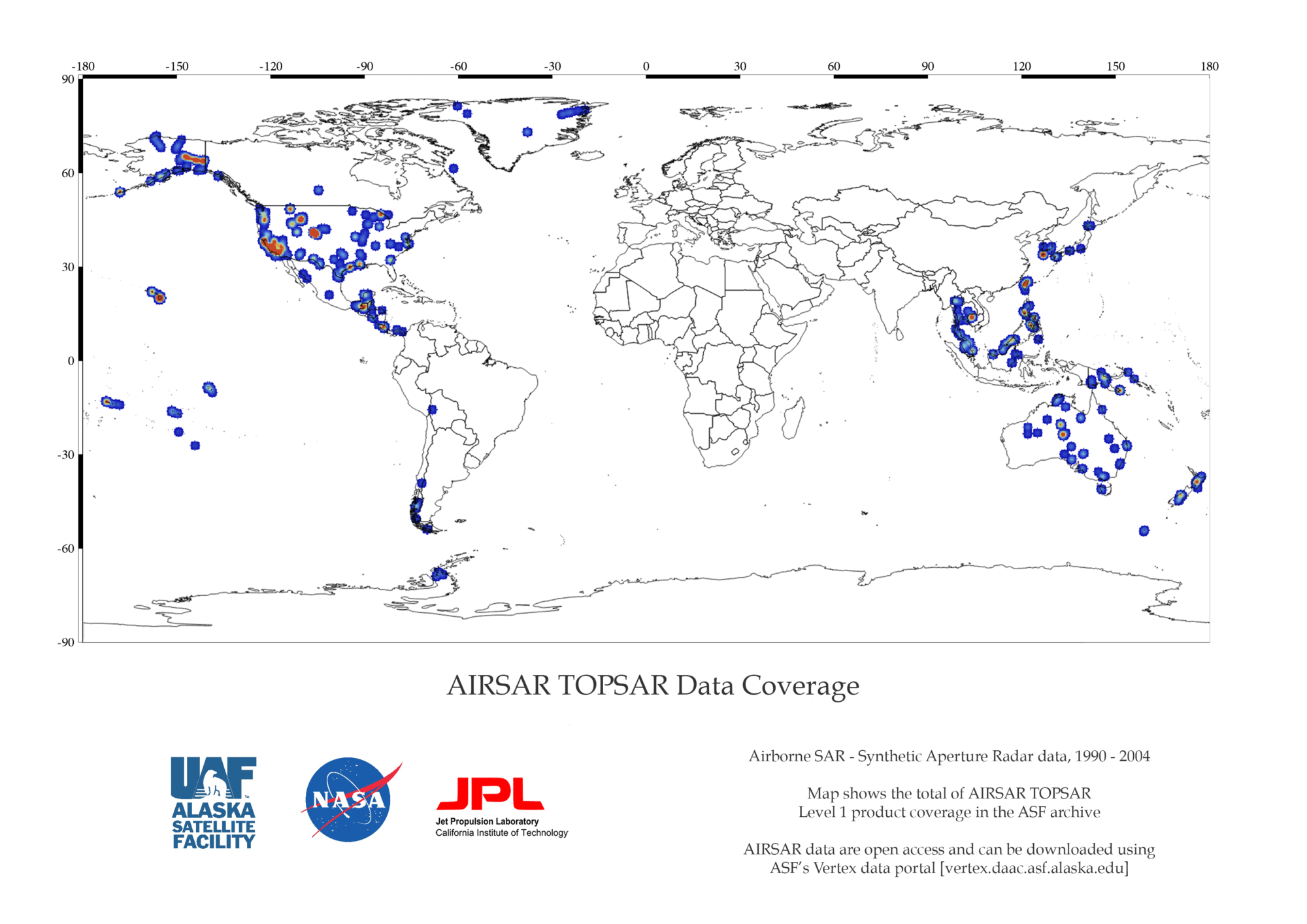
AIRSAR DEM Coverage Map
Data Formats and Files
AIRSAR TOPSAR data formats and files
| Format | Product Name | Product Files | Open-source Tools | Can Be Used For |
|---|---|---|---|---|
| AIRSAR | C-band DEM and Compressed Stokes Matrix | c.corgr, c.demi2, c.vvi2 | MapReady, PolSARpro | Polarimetry |
| AIRSAR | L-band Compressed Stokes Matrix | l.datgr | MapReady, PolSARpro | Polarimetry |
| AIRSAR | P-band Compressed Stokes Matrix | p.datgr | PolSARpro | Polarimetry |
AIRSAR PolSAR – AIRSAR ATI (Experimental) data formats and files
| Format | Product Name | Product Files | Processing Level | Open-source Tools | Can Be Used For |
|---|---|---|---|---|---|
| AIRSAR | 3-Frequency Polarimetry | c.dat, l.dat, p.dat | Compressed stokes matrix | MapReady, PolSARpro | Polarimetry |
| JPG | Along-Track Interferometry | *intf*, *uwScc*, *az*, *uwWrp*, *uwWcc*, *uwWrp, *par, *ppp | SLC, MLC | N/A | Ocean current velocity measurement |
AIRSAR Dataset and DOI
| Dataset | DOI |
|---|---|
| AirSAR_TOPSAR | 10.5067/F1SC87EFGT9U |