ERS-1
Table of contents
Add a header to begin generating the table of contents
The ERS-1 mission phases are listed below. For more information on each phase, see the Delft University of Technology website, which retrieved the information originally from ESA/ESRIN.
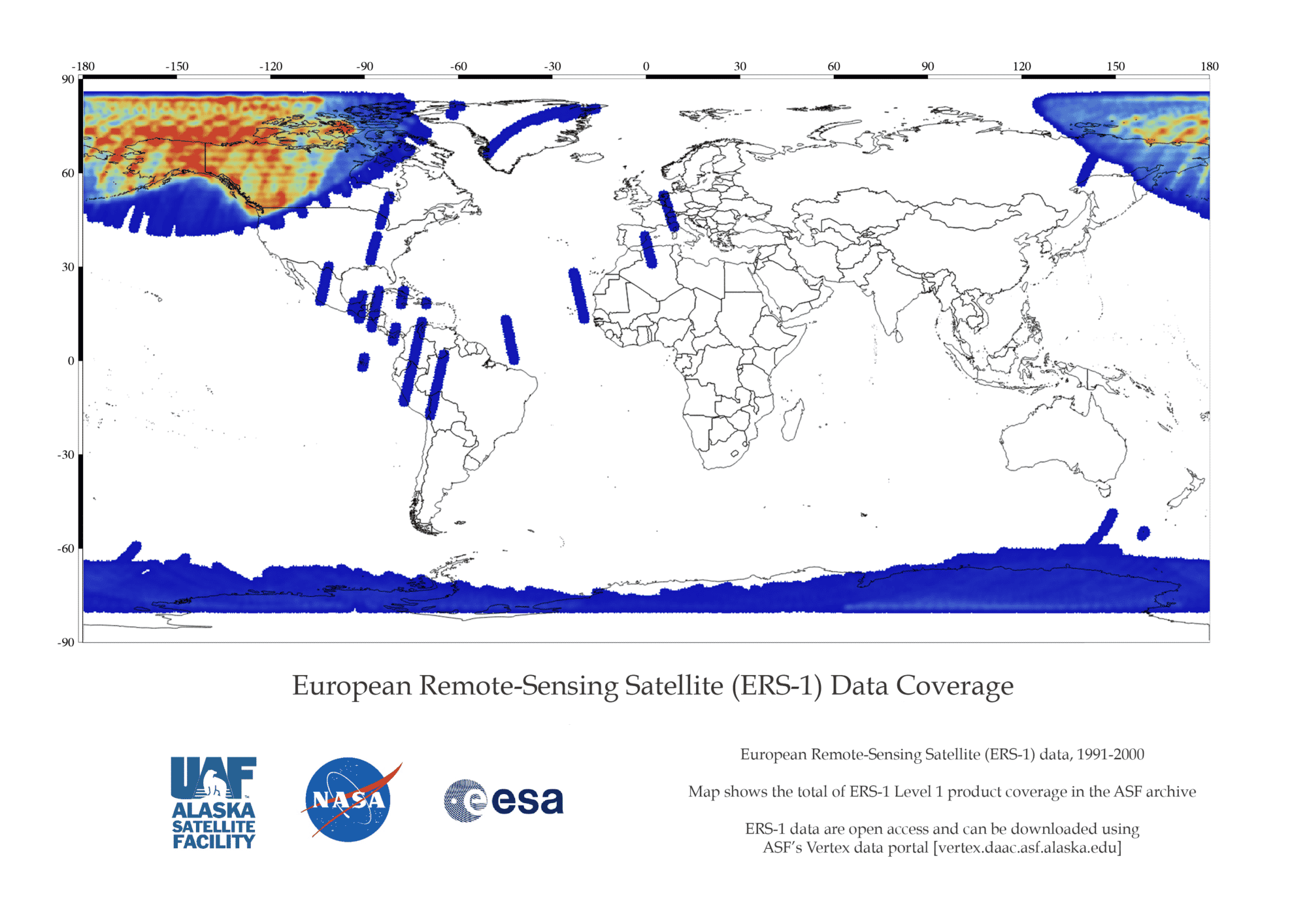
ESA ERS 1 Data Coverage Map
ERS 1 Missions
The ERS-1 mission phases are listed below. For more information on each phase, see the Delft University of Technology website, which retrieved the information originally from ESA/ESRIN:
A. Commissioning Phase: 25-Jul-91 to 10-Dec-91
B. Ice Phase: 28-Dec-91 to 30-Mar-92
R. Roll Tilt Mode Campaign: 4-Apr-92 to 13-Apr-92
C. Multidisciplinary Phase: 14-Apr-92 to 21-Dec-93
D. Second Ice Phase: 23-Dec-93 to 10-Apr-94
E. First Geodetic Phase: 10-Apr-94 to 28-Sep-94
F. Second Geodetic Phase: 28-Sep-94 to 21-Mar-95
G. Tandem Phase: 21-Mar-95 to 5-Jun-96
ERS-1 Datasets and DOIs
ERS-1 Datasets and DOIs
| Dataset | DOI |
|---|---|
| L0_ERS-1 | 10.5067/GKOFAHGFBETY |
| L1_ERS-1 | 10.5067/M7502I707TVZ10.5067/M7502I707TVZ |


