

JERS-1
Table of contents
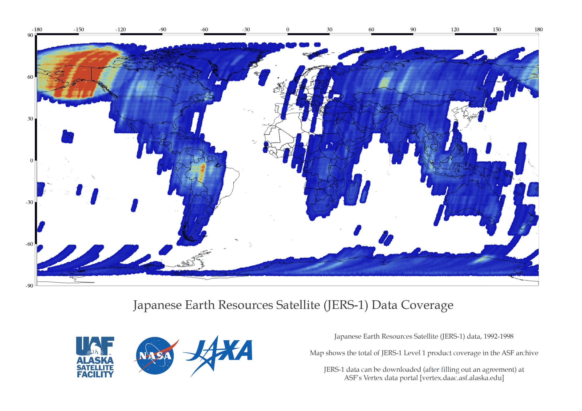
JERS 1 Coverage Map
Mission
The JERS-1 (Japanese Earth Resources Satellite) SAR is a high-resolution, all-weather imaging radar. Its primary objective was gathering data on global land masses while conducting observation for land surveys, agriculture, forestry, fisheries, environmental protection, disaster prevention, and coastal surveillance.
Launch
JERS-1 was launched by the Japan Aerospace Exploration Agency (JAXA), aboard a Japanese H-1 launcher, to provide global and repetitive observations of the environment using techniques that allow imaging to take place in all weather conditions.
Achievement
The JERS-1 Global Forest Mapping Program mapped important forests of the world: Southeast Asia, Africa, Central America, South America (Amazon Basin), and Boreal North America. ASF distributes the Amazon and Boreal forest SAR mosaics.
Datasets and DOIs
| Dataset | DOI |
|---|---|
| L0_JERS-1 | 10.5067/CRIS7FUD12QF |
| L1_JERS-1 | 10.5067/P882O8BV02R2 |