Alaska Satellite Facility - Distributed Active Archive Center

Table of contents

    Add a header to begin generating the table of contents

    Coverage Maps

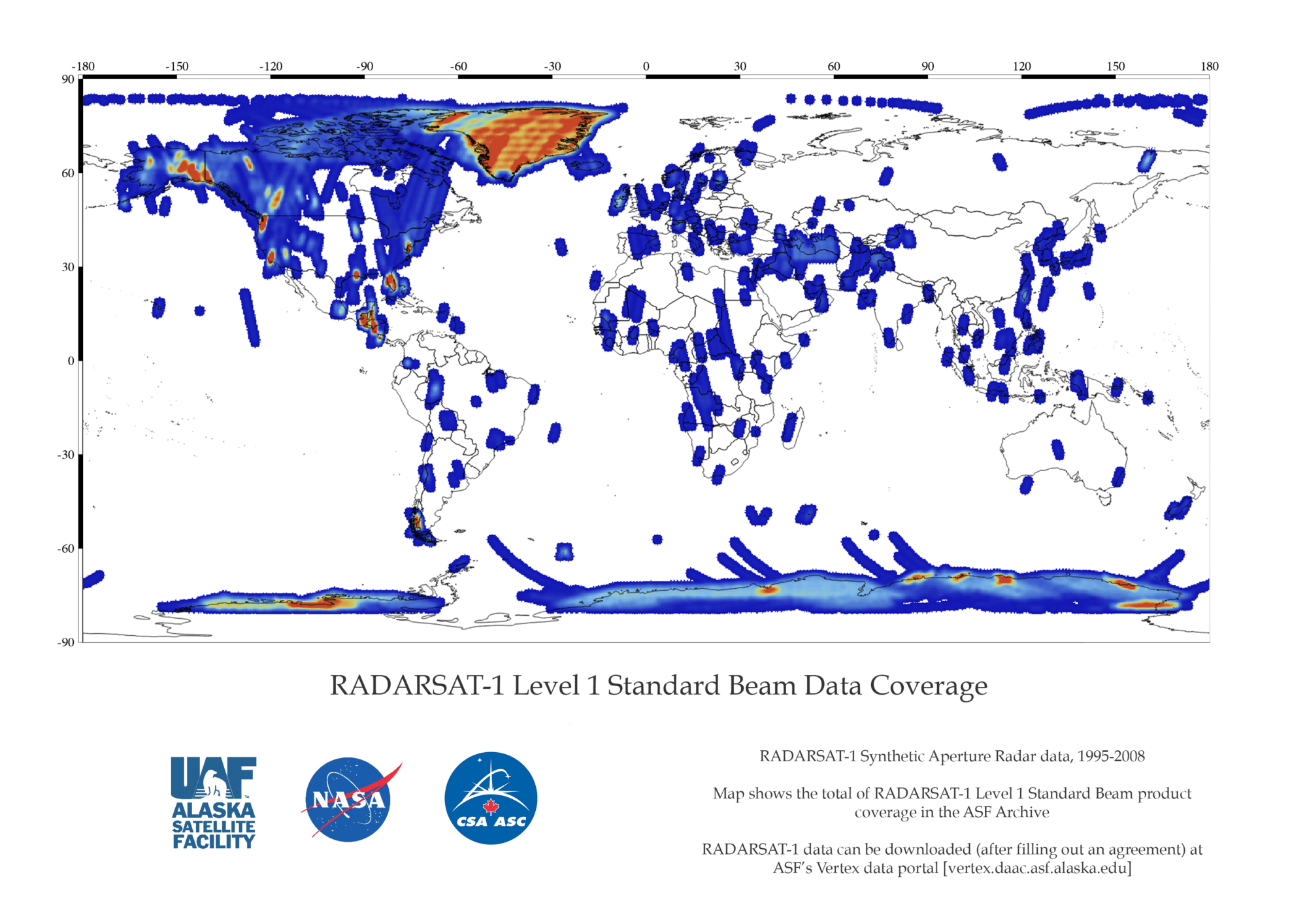
    RADARSAT-1 Level 1 Standard Beam Data Coverage

    RADARSAT-1 Fine Beam Acquisitions
    RADARSAT-1 Fine Beam Acquisitions

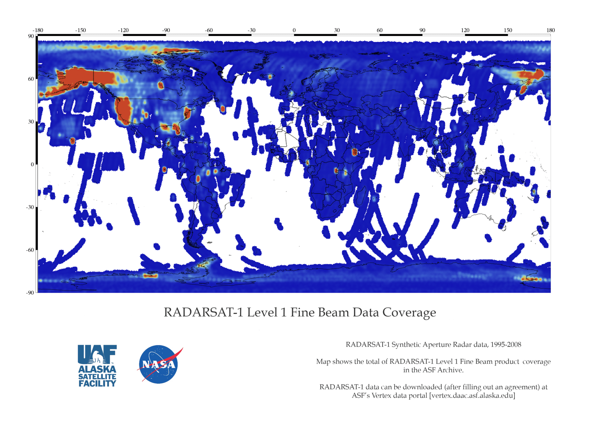
    RADARSAT-1 Level 1 Fine Beam Data Coverage

    RADARSAT-1 Standard Beam Acquisitions
    RADARSAT-1 Standard Beam Acquisitions

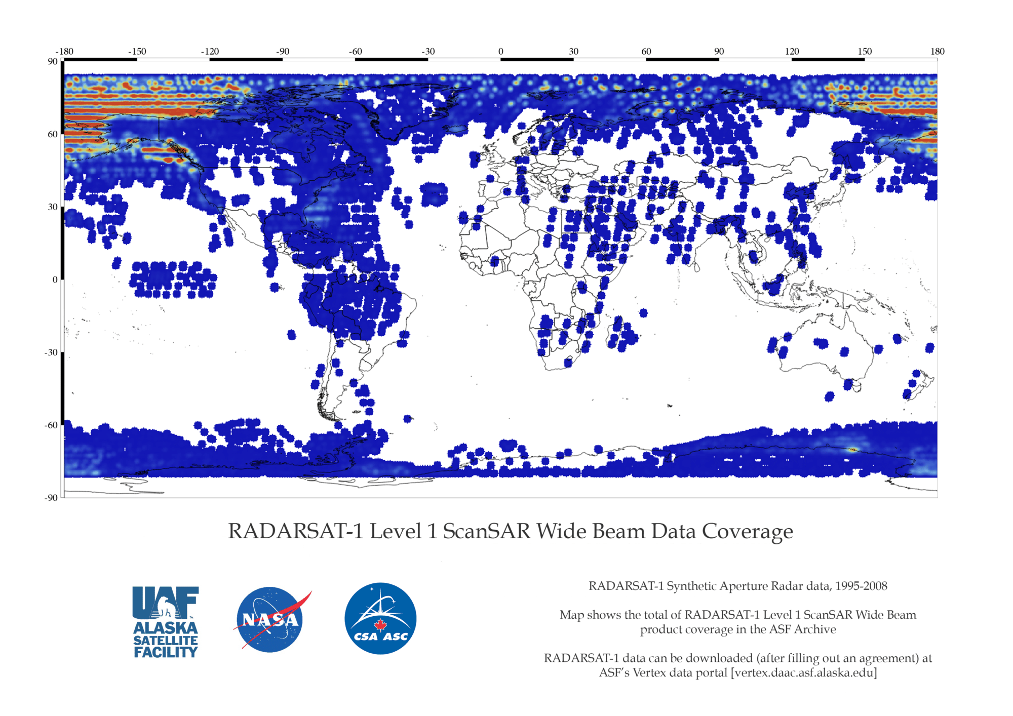
    RADARSAT-1 Level 1 ScanSAR Wide Beam Data Coverage

    RADARSAT-1 ScanSAR Wide Acquisitions
    RADARSAT-1 ScanSAR Wide Acquisitions

    Instrument

    RADARSAT-1 Instrument Diagram
     

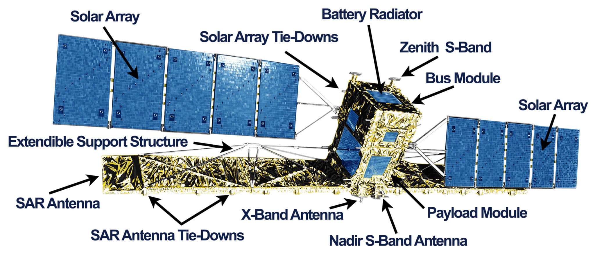
    RADARSAT-1 was equipped with a powerful SAR sensor. It transmitted and received signals to capture high-quality images of the Earth night and day and in all weather conditions. RADARSAT-1 transmitted a microwave energy pulse (C-band at 5.3 GHz frequency) to Earth, and the SAR measured the amount of energy reflected back to the satellite from the Earth’s surface.

    The RADARSAT-1 instrument was able to shape and steer its radar beam using C-band. A wide variety of beam widths were available to capture swaths of 45 to 500 kilometers, with a range of 8 to 100 meters in resolution and incidence angles of 10 to 60 degrees.

    SAR Modes

    Radarsat-1 Beam Modes


    ParameterFine Beam ModeStandard Beam ModeScanSAR Beam Mode
    Center Frequency5.3 GHz/C-band 5.6 cm5.3 GHz/C-band 5.6 cm5.3 GHz/C-band 5.6 cm
    PolarizationHHHHHH
    Spatial Resolution8 m30 m50-100 m
    Swath Width45 km100 km300-500 km
    Off-Nadir Angle37-47°20-49°20-49°

    Documents and Tools

    The RADARSAT Data Product Specifications Guide provides an overview of the endorsed products generated by the RADARSAT program. This document outlines the suite of available RADARSAT products, the product delivery options, and product attributes such as image quality, resolution and size. The CEOS format for RADARSAT data is also defined for each record in structure and contents.

    RADARSAT-1 Data Product Specifications