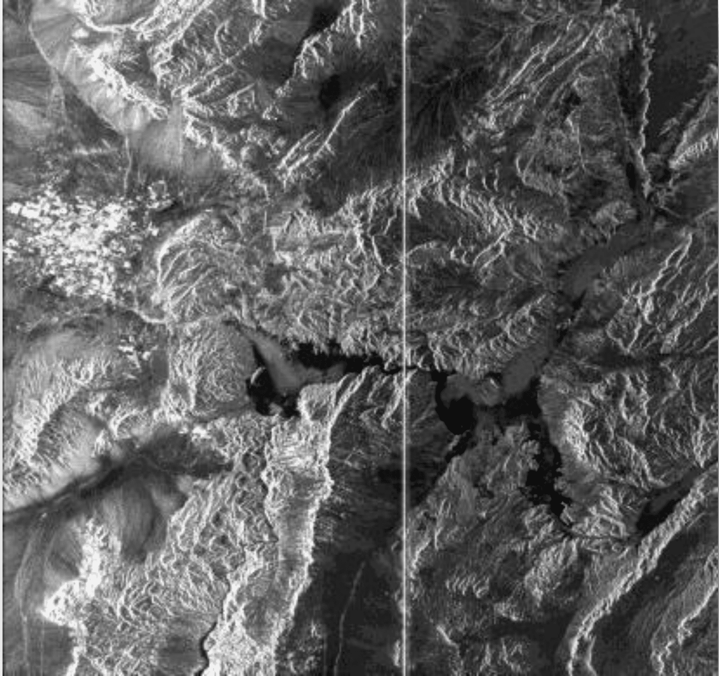
Las Vegas is on the left in this detail of the Seasat sample granule provided with this recipe. Credit: NASA 1978, processed by ASF DAAC 2013.
Background
To distribute digitally processed 1978 Seasat SAR data in 2013, engineers used the most recent version of the Hierarchical Data Format, or HDF5 file format. These Seasat HDF5 files are viewable using the ASF MapReady image processing software. Each HDF5 file consists of a metadata group and a data group, which contain the SAR data as backscatter values in the HH layer, as well as latitude, longitude, and temporal data.
Seasat data had been archived on magnetic tapes, and images processed from the tapes were available only as optical images of film strips or scanned digital images. Neither the tapes nor the film allow the quantitative analysis possible with the new digital archive.
Prerequisites
Materials List:
- Windows PC
- ASF MapReady
- HDF5-format Seasat Granule or Sample Granule
Steps
Download Materials
- Download ASF’s MapReady
- Install MapReady using the Installation Wizard
- Download an HDF5-formatted data granule from the Seasat collection using Vertex, or use the Sample Granule.
- Create a working directory and extract the .zip file
View Data
Option 1 — ASF View
- Click on the Windows Start button
- Open ASF View
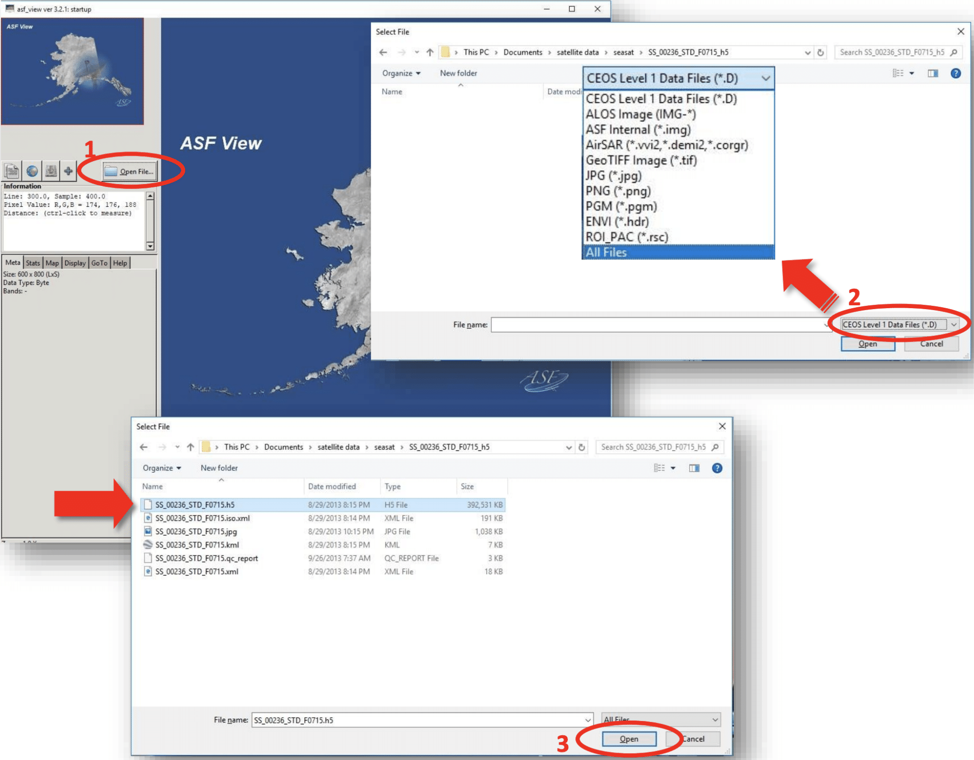
- Click on Open File… (1) and navigate to the folder that contains the Seasat file you downloaded
- Click to expand the file type menu in the bottom-right corner and select All Files (2)
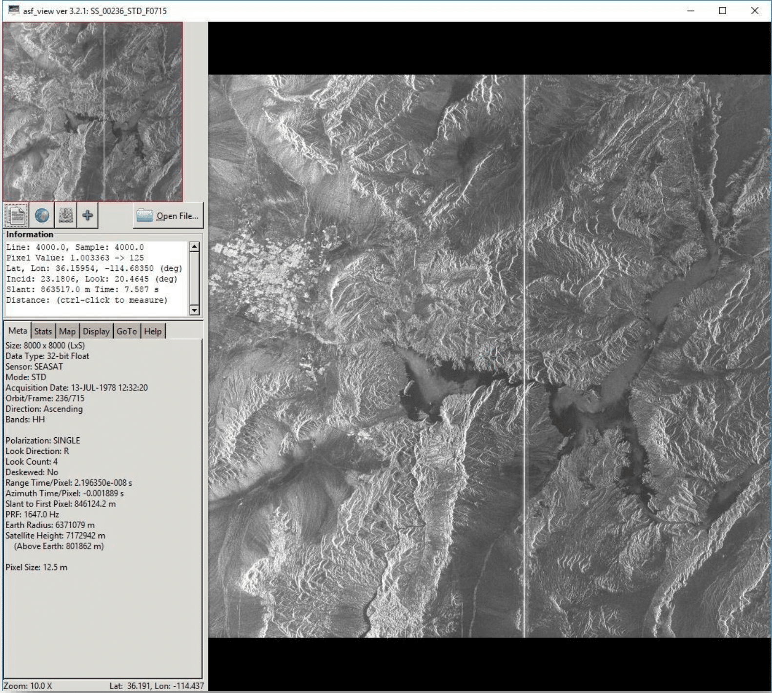
- Then select the .h5 file and click Open (3), in which the Seasat image and metadata will be displayed
Option 2 — ASF MapReady
- Open ASF MapReady
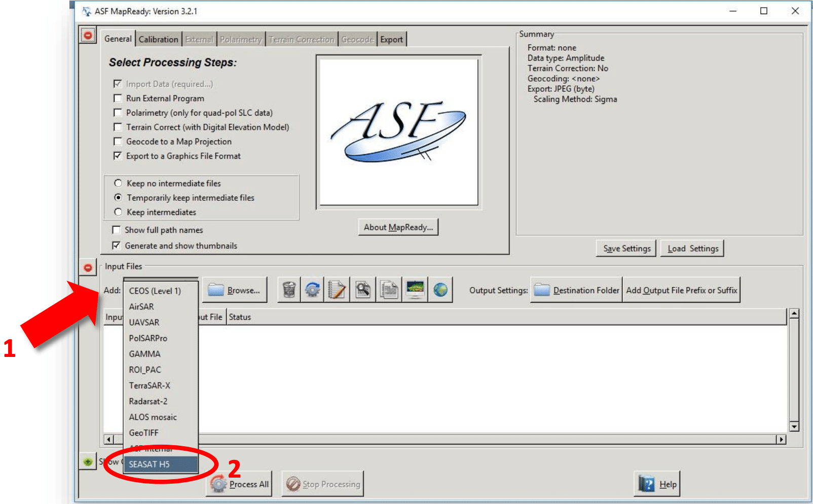
- In the Input Files section, click the button to Add: (1) to expand the menu, then select SEASAT H5 (2)
- Click on the Browse… button (3) and navigate to the folder with the Seasat file you downloaded
- Select the .h5 file and click Open (4)
- The Seasat file will be displayed in the Input File window
- Click on the viewer button in the toolbar to view the file
- The image will open in ASF View, a viewer application which can also display CEOS-format data and many other image-processing formats.
Hint: Press the End key on your keyboard to zoom out and view the entire image
Note: ASF View can be opened directly by navigating to the folder below and double-clicking on asf_view.exe
C:\Program Files (x86)\ASF_Tools\MapReady 3.2


