


SAR imaging can reveal many of the features and patterns of sea ice. By comparing successive SAR images, scientists can track changes in sea ice position and deformation.
These data aid in better understanding ice dynamics, predicting sea ice drift, and assessing navigation risks. Continuous monitoring using SAR enables near-real-time updates of sea ice conditions crucial to maritime operations and climate research. SAR provides essential information for safe and strategic navigation through icy waters.
Sea Ice Motion
Location: Bering Strait
Date(s): September 2, 2002 – June 17, 2003
Spacecraft/Agency: RADARSAT-1 / Canadian Space Agency (CSA).
Credit: © CSA 2002, 2003.
Sea ice is the central player in a dynamic system that affects the planet’s oceans and climate. It is also a force to be reckoned with as polar waters open to human activity. Shipping already takes place through the Northern Route along the coast of Russia and is potentially slated for the fabled Northwest Passage along the coast of Canada. Sea-ice motion is a critical factor in the thinning and melting of Arctic sea ice, as it forms rafts and ridges, opens into leads and polynyas, and is moved by winds and currents through and out of the Arctic.
This sequence of RADARSAT-1 satellite images of the Bering and Chukchi Seas was compiled from data acquired 24 days apart over the course of 1 year. The process of seasonal ice formation and dissolution, and the dynamics in winter of pack ice as it is moved by currents, wind, and the constriction of continents, is dramatic when viewed from space.
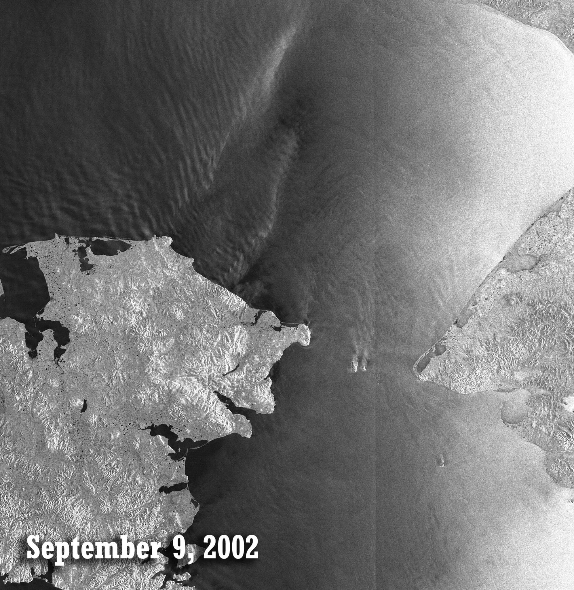
September 9, 2002
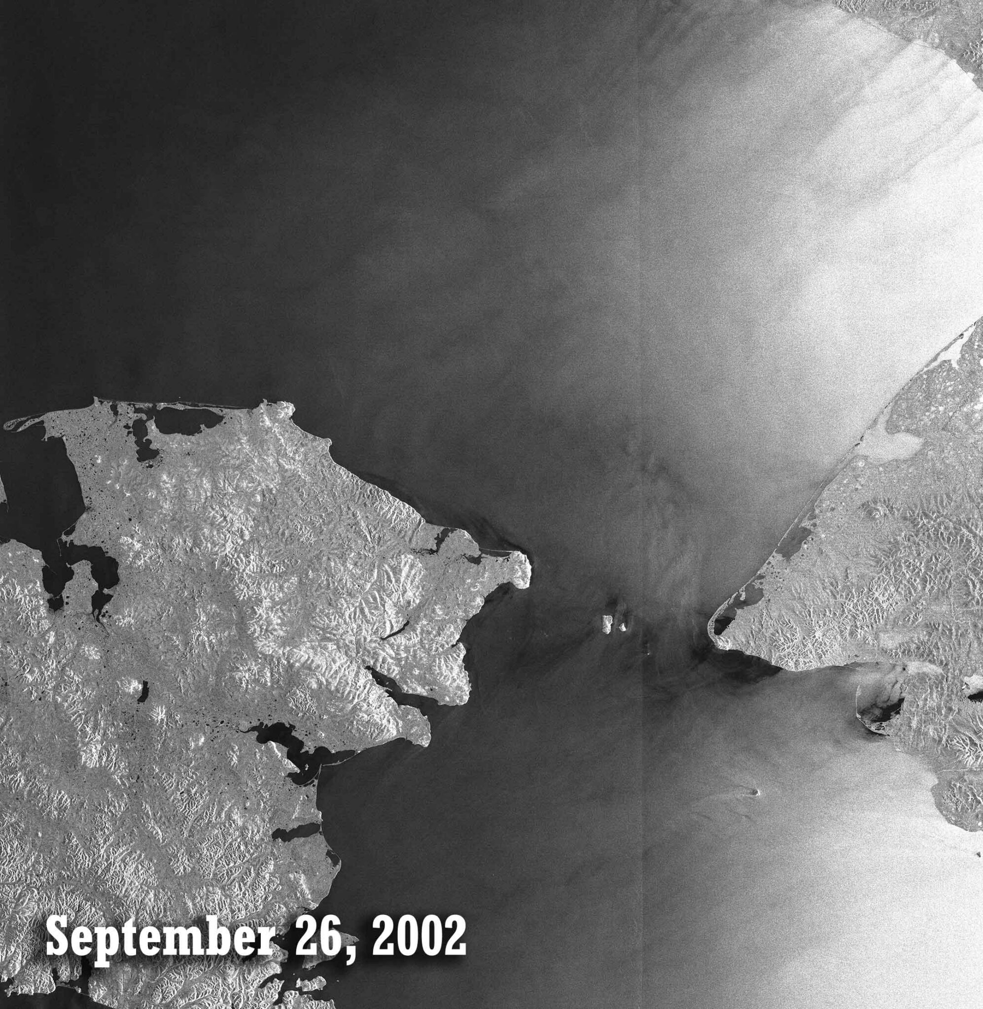
September 26, 2002

October 20, 2002
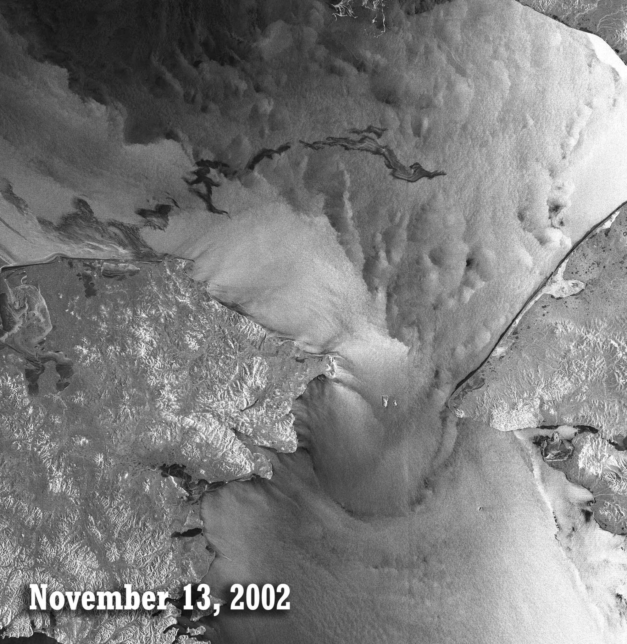
November 13, 2002

December 31, 2002
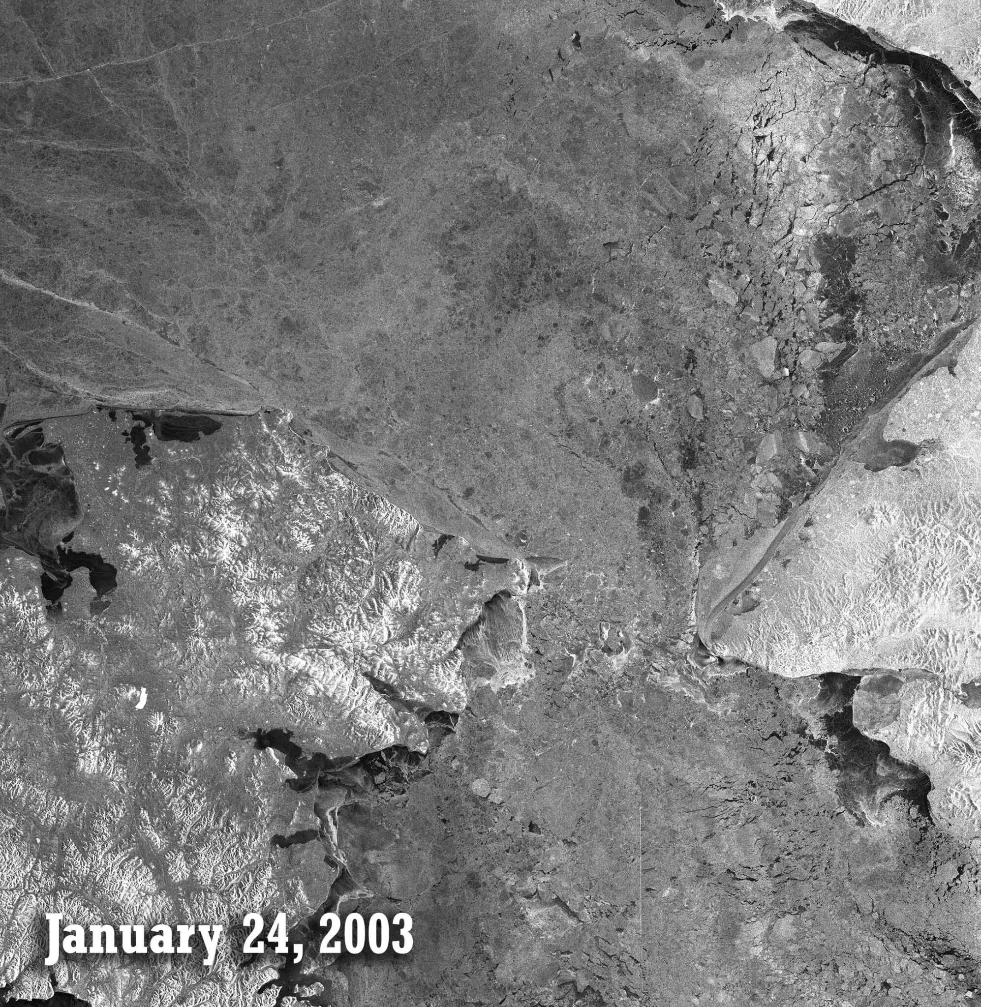
January 24, 2003
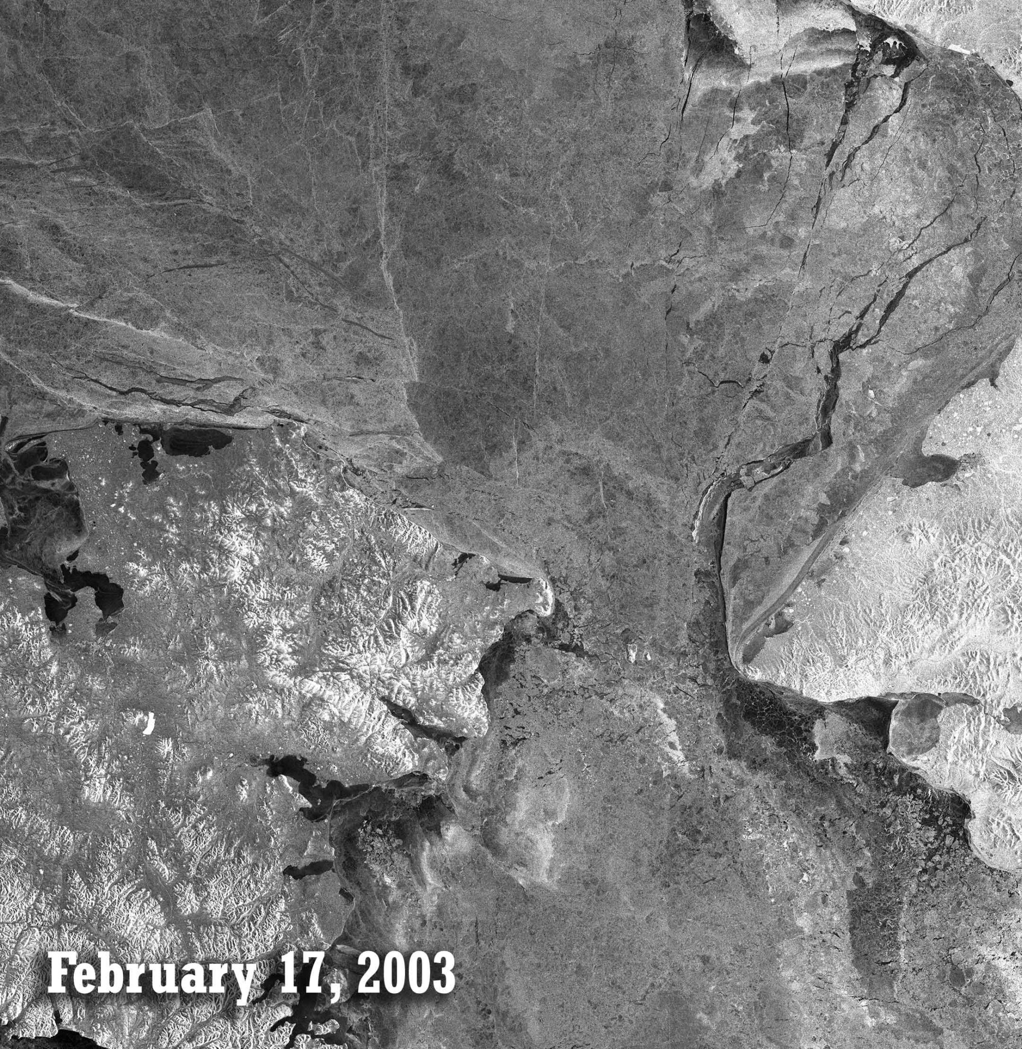
February 17, 2003
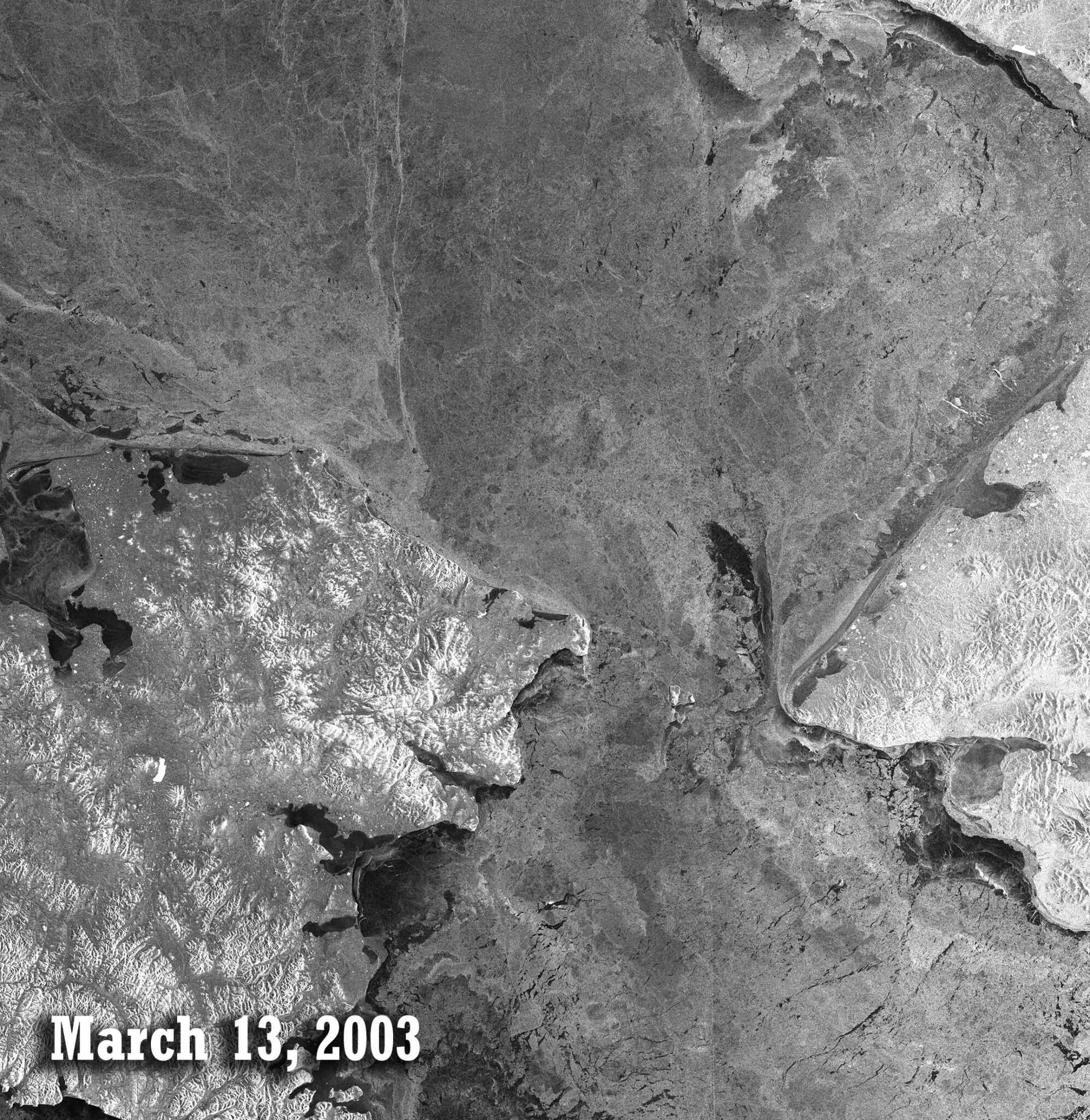
March 13, 2003
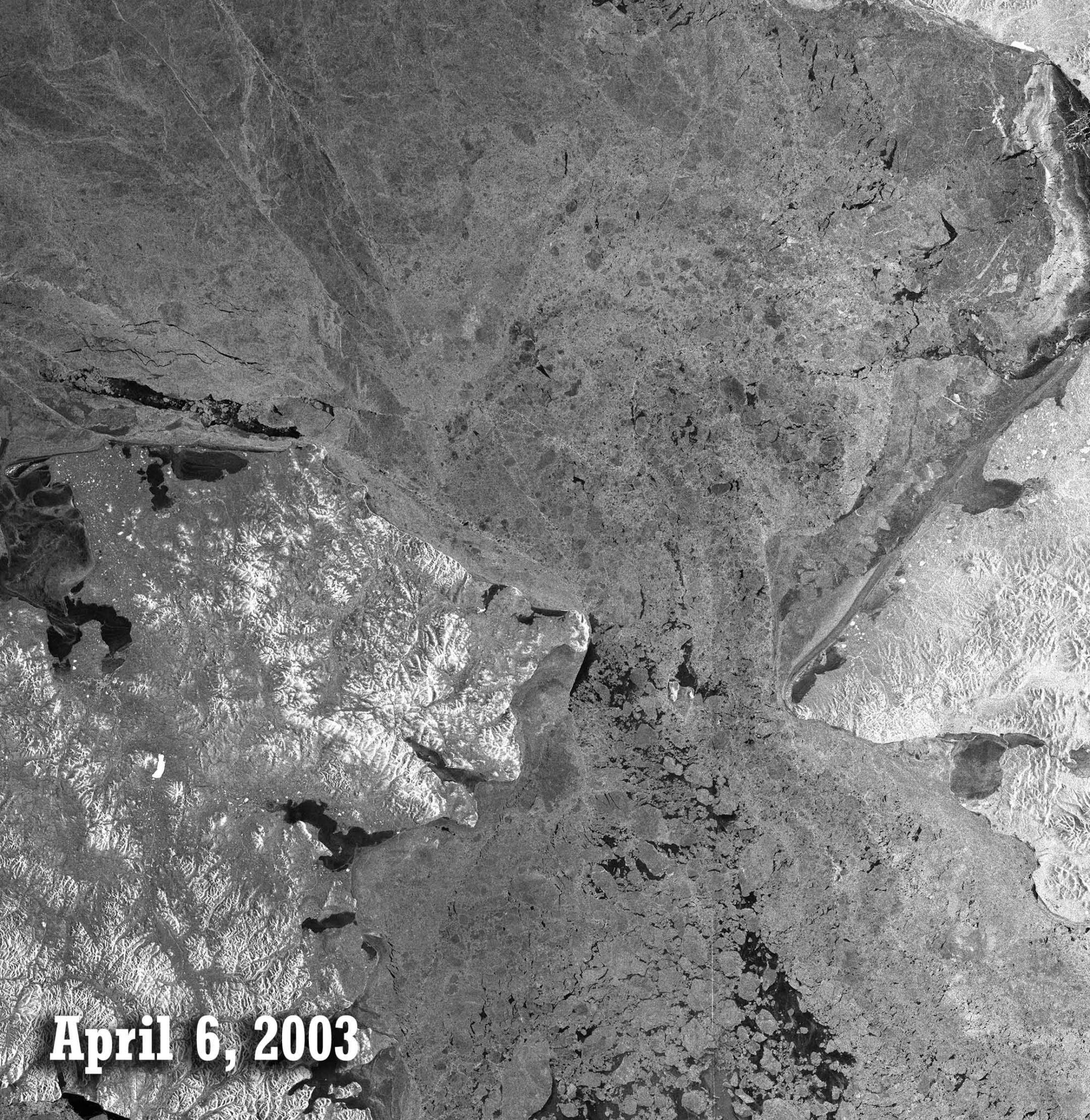
April 6, 2003

April 30, 2003
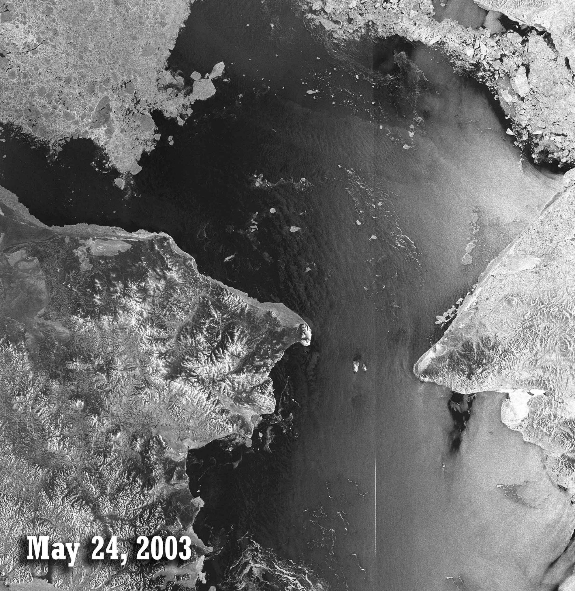
May 24, 2003
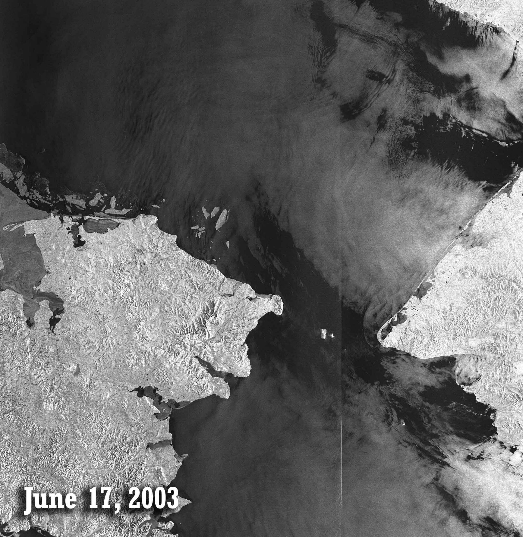
June 17, 2003
Animated sequence
Click the video for an amination of the seasonal changes and sea-ice movement. Images taken in 24-day intervals.
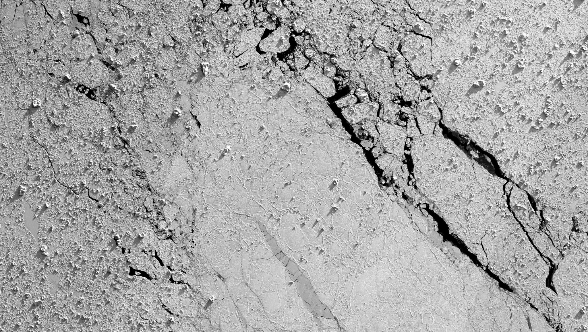
Pack Ice
Location: Weddell Sea, Antarctica , 2007
Date(s): unknown
Spacecraft/Agency: ALOS / Japan Aerospace Exploration Agency (JAXA)/
Credit: © JAXA 2007.
The PRISM (Panchromatic Remote Sensing Instrument for Stereo Mapping) optical instrument utilized three hi-resolution cameras pointed forward, down, and back to create stereoscopic views of the Earth’s surface for the production of highly accurate digital elevation
models. This image of pack ice in the Weddell Sea was taken with the downward-looking camera. Details in the ice surface are accentuated by the sunlight of the Antarctic spring.
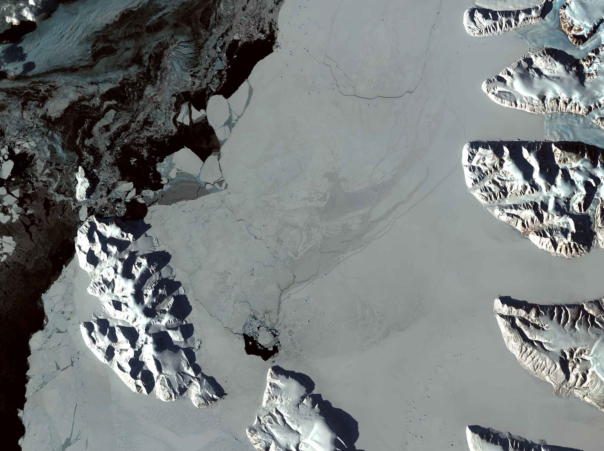
Arctic Spring
Location: Baffin Bay, Greenland
Date(s): 2008
Spacecraft/Agency: ALOS / Japan Aerospace Exploration Agency (JAXA).
Credit: © JAXA 2008.
In this Advanced Land Observing Satellite (ALOS) AVNIR-2 image acquired March 25, 2008, late-afternoon shadows are pronounced along the northwestern coast of Greenland at the northern tip of Baffin Bay. Coastal sea ice has begun its retreat as the Arctic spring rapidly approaches.