







SAR data is vital for monitoring glacier movement due to its sensitivity to surface change.
By comparing SAR images acquired at different times, scientists can track glacier displacement, revealing flow velocities and deformation patterns. InSAR (Interferometric SAR) techniques create accurate displacement maps, enabling precise measurement of glacier motion. These data aid in understanding glacial dynamics, studying climate-related impacts, and assessing potential hazards such as glacier surges.
Demonstrated Potential
Location: Southeast Alaska
Date(s): 2006
Spacecraft/Agency: ALOS / Japan Aerospace Exploration Agency (JAXA).
Credit: © JAXA 2006.
The Malaspina Glacier flows from the Wrangell-St. Elias Mountains in Southeast Alaska onto the coastal plain north of Yakutat Bay and is the largest Piedmont glacier in the world. Current research indicates that the glacier is rapidly melting and may eventually form a new ocean bay, transforming the landscape and ecosystem of southeast Alaska.

Transformation
Location: Yakutat Bay
Date(s): 1978
Spacecraft/Agency: Seasat / NASA.
Credit: NASA 1978.
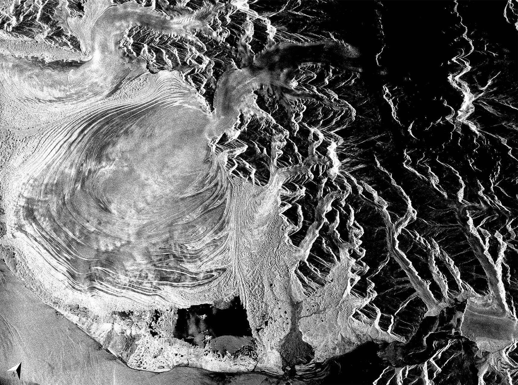
Seasat was launched by NASA in 1978 and was the earliest Earth-observing satellite to include a synthetic aperture radar instrument. Though the mission ended after 100 days, Seasat demonstrated the potential of spaceborne SAR as an Earth observation tool. This image shows the Malaspina Glacier, which exits the mountains of the St. Elias range and spreads onto the coastal plain of Yakutat Bay.
Distortions
Location: Wrangell-St. Elias National Park, Alaska
Date(s): October 8, 2006
Spacecraft/Agency: RADARSAT-1 / Canadian Space Agency (CSA).
Credit: © CSA 2006.
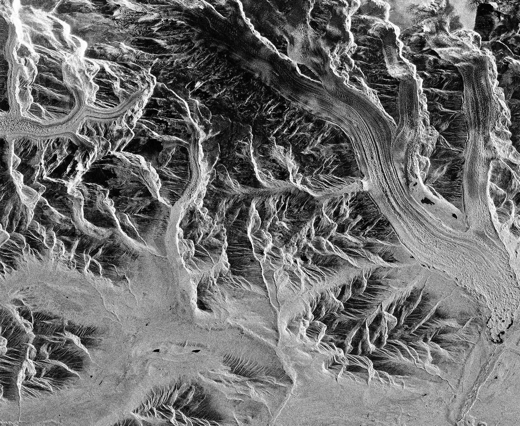
This RADARSAT-1 image shows the Kennicott Glacier and its tributaries – the Root, Gates, and LaChapelle Glaciers – as they flow through the heart of Wrangell-St. Elias National Park, Alaska, the largest National Park in the United States. TheThis RADARSAT-1 image displays the geometric distortions characteristic of side-looking radar imaging; for example, mountains appear to “layover” and surfaces appear abnormally dark or bright. Techniques have been developed to correct these distortions so that landscape features appear correctly oriented and illuminated.
Decorrelation
Location: Wrangell-St. Elias National Park, Alaska
Date(s): 2007
Spacecraft/Agency: ALOS / Japan Aerospace Exploration Agency (JAXA).
Credit: JAXA/METI 2007; courtesy F. Meyer.
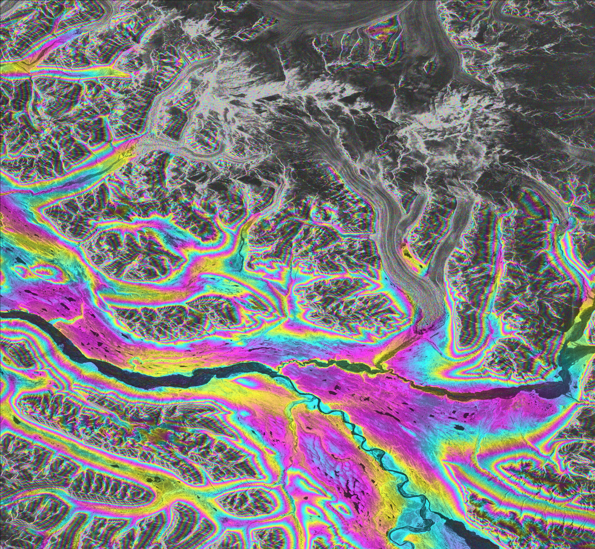
The movement of glaciers between repeat passes of a satellite causes decorrelation of the phase signal returned from the glacier ice. This decorrelation, or loss of coherence, can be used by scientists to map the glacier and study how it changes through time. This Advanced Land Observation Satellite (ALOS) PALSAR interferogram shows the Kennicott Glacier in the Wrangell-St. Elias National Park, Alaska.
Brittle Front
Location: Greenland
Date(s): 2009
Spacecraft/Agency: UAVSAR / NASA.
Credit: NASA JPL 2009.
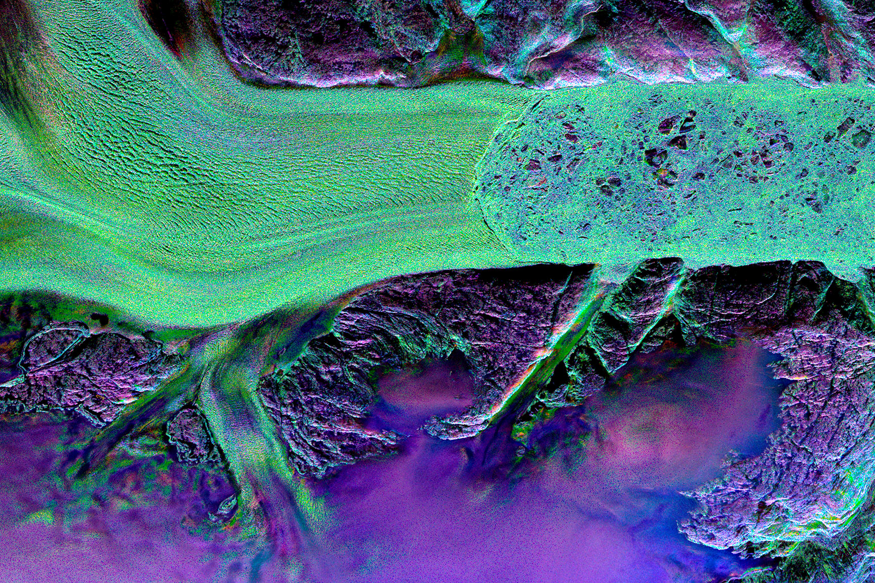
This UAVSAR image shows Helheim Glacier in southeastern Greenland. The flow of ice originates from the Greenland ice sheet, passing through a narrow rift in the coastal mountain range and into the sea. Where the water is deep enough to cause the end of the glacier to float, the front becomes brittle and it breaks into numerous icebergs. After years of melting back at a relatively stable speed, Helheim Glacier has dramatically accelerated its retreat in the past decade. The colors in this image come from a Yamaguchi decomposition of JPL’s UAVSAR polarimetric data. Such a decomposition is especially useful for looking at complex geometries, where the RED channel might be used to indicate the intensity of the signal and GREEN the phase difference between successive images.