







SAR data is instrumental in monitoring coastal erosion due to its ability to capture large-scale changes over time.
By comparing SAR images acquired at different periods, experts can detect shifts in shoreline position and track the rate of erosion. This data aids in assessing vulnerability and formulating strategies for coastal protection. SAR’s consistent imaging, regardless of weather or light conditions, provides reliable insights into erosion patterns and impacts. In essence, SAR enables timely and accurate assessment of coastal dynamics, facilitating effective management and mitigation of erosion-related challenges.
Oil Spill
Location: Red Sea
Date(s): October 22, 2019
Spacecraft/Agency: Sentinel-1 / European Space Agency (ESA).
Credit: Contains modified Copernicus Sentinel data 2019, processed by ESA; courtesy R. Gens.
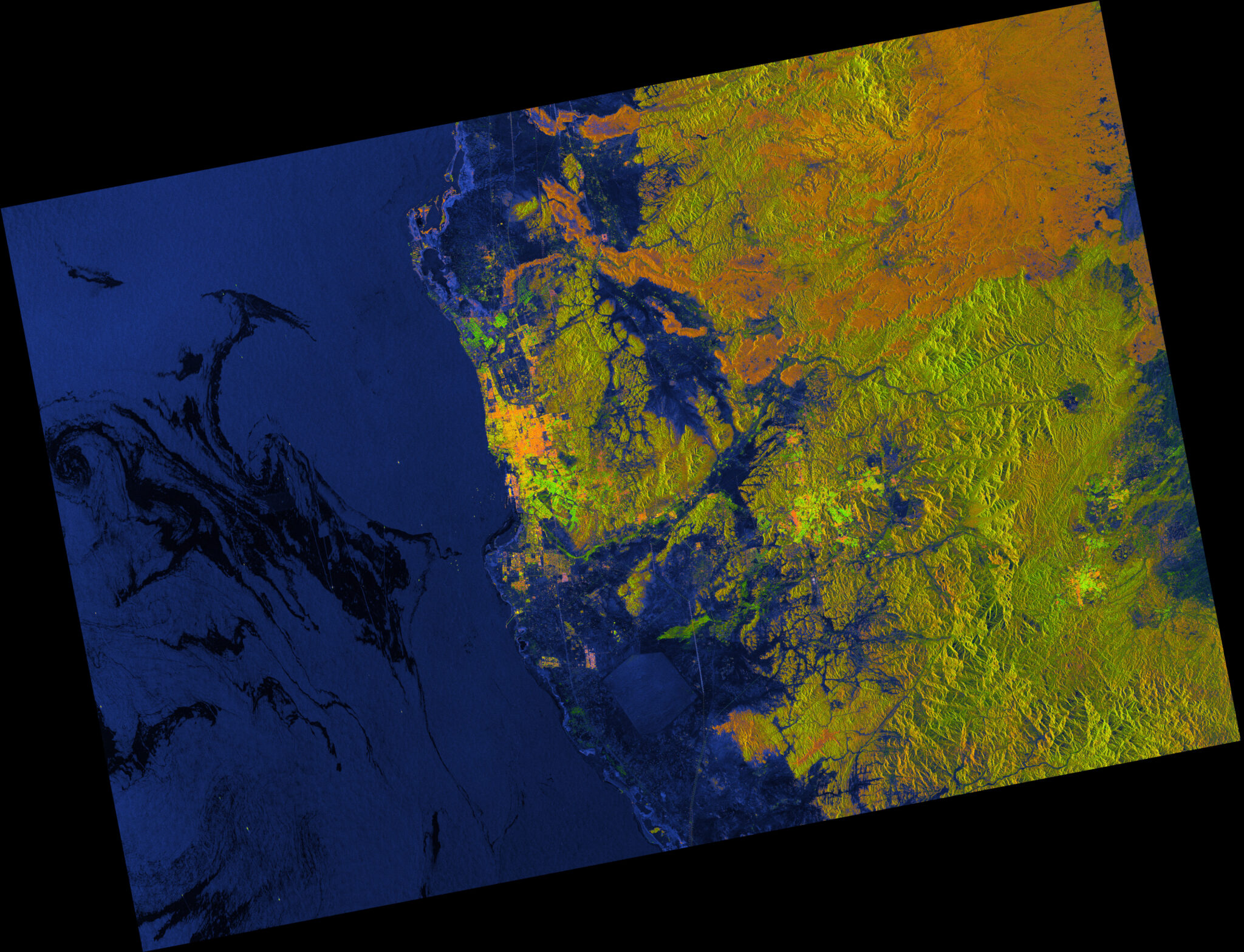
This Sentinel-1 RGB decomposition image shows an oil spill in the Red Sea near the Saudi Arabian city of Jeddah. The spilled oil makes the ocean surface smoother than the surrounding water and, therefore, is displayed as darker blue pixels compared to the regular blue pixels of the decomposition.
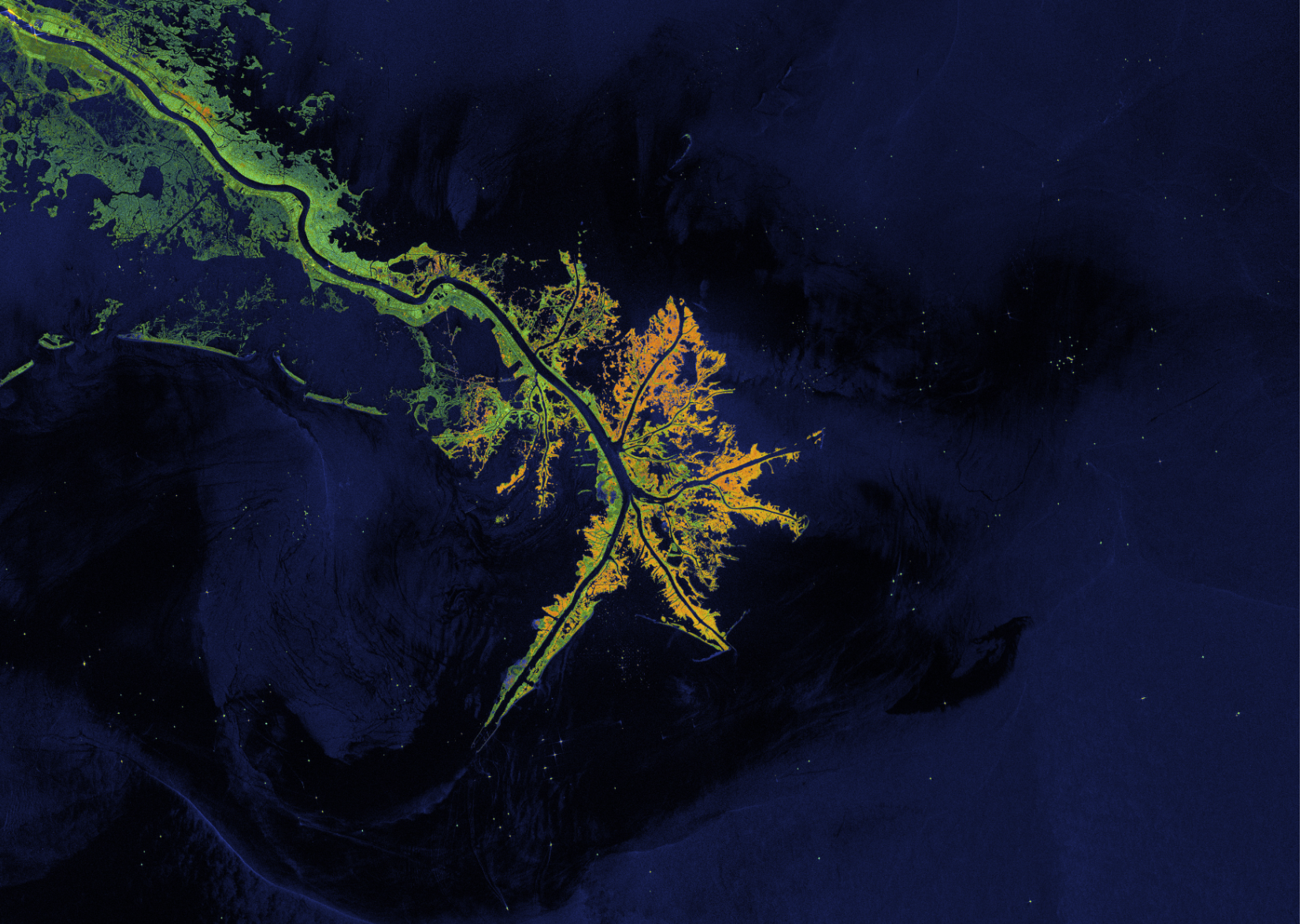
The Bird's Foot Delta
Location: Mississippi River
Date(s): 2018
Spacecraft/Agency: Sentinel-1 / European Space Agency (ESA).
Credit: Contains modified Copernicus Sentinel data 2018; courtesy R. Gens.

Hurricane
Location: Mississippi River
Date(s): 2021
Spacecraft/Agency: Sentinel-1 / European Space Agency (ESA).
Credit: Copernicus Sentinel data 2021.
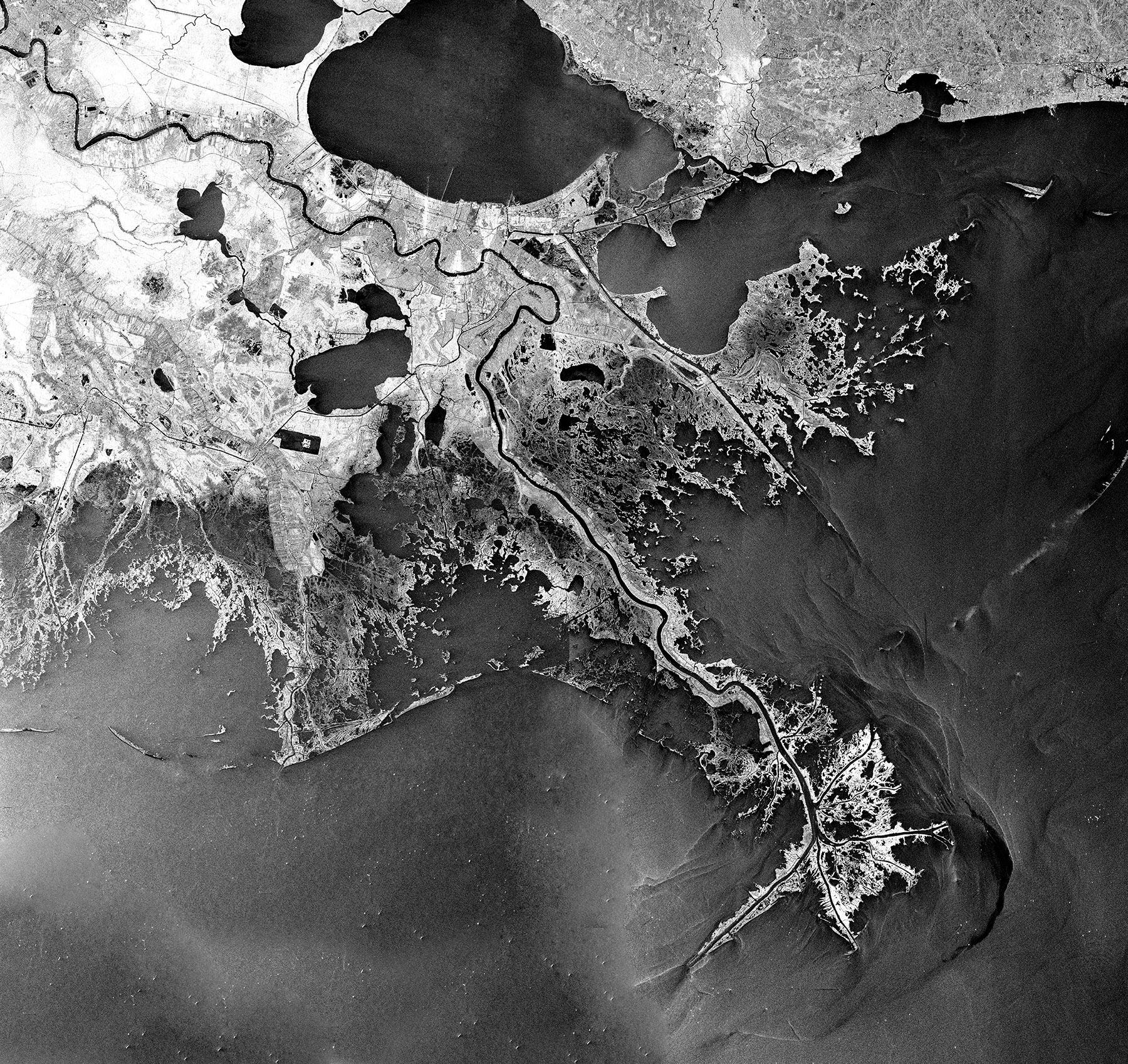
Alluvial Plain
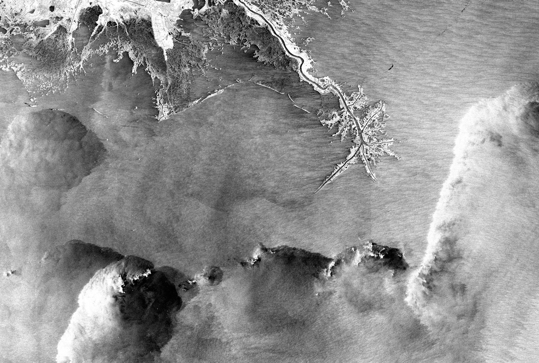
Location: Mississippi River
Date(s): 2004
Spacecraft/Agency: RADARSAT-1 / Canadian Space Agency (CSA).
Credit: © CSA 2004.
This Mississippi River Delta image was created by combining four RADARSAT-1 standard beam frames. The bird’s foot shape of the alluvial plain is caused by the deposition of large sediment loads into deep water. Lake Pontchartrain is the large body of water at the top of the image, and New Orleans is located just south of the lake.
Vibrant Vegetation
Location: Bird’s Foot Delta, Mississippi River
Date(s): 2009
Spacecraft/Agency: ALOS / Japan Aerospace Exploration Agency (JAXA).
Credit: © JAXA 2009.
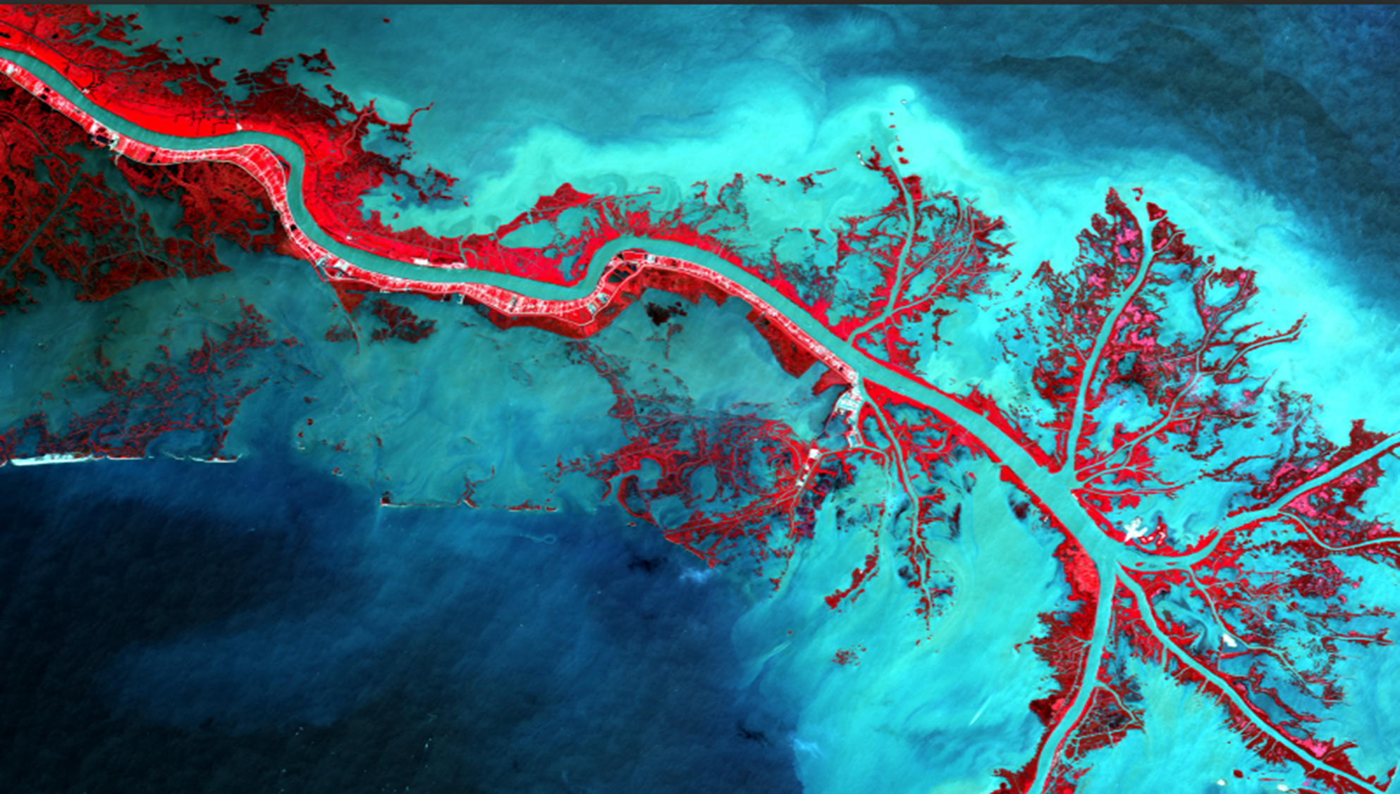
In this Advanced Land Observation Satellite (ALOS) AVNIR-2 sensor image of the Mississippi Delta, the vibrant red colors highlight areas of vegetation and contrast dramatically with the blue waters of the Gulf of Mexico. Although the Mississippi waterway has now been channelized, the dendritic structure of the Delta exemplifies the process of sediment deposition.