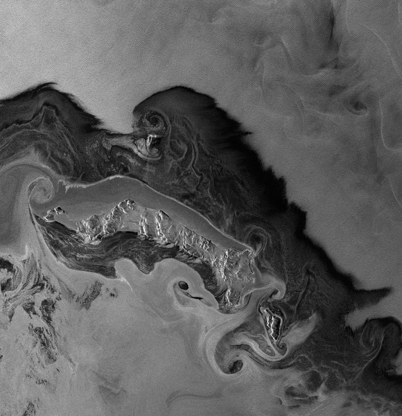
Wind-roughened water can backscatter brightly in the presence of capillary waves, which occur when the resulting waves are close in size to the incident radar’s wavelength.
Surfaces
Rough surfaces appear brighter, as they reflect the radar in all directions, and more of the energy is scattered back to the antenna. A rough surface backscatters even more brightly when it is wet.
Surface variations near the size of the radar’s wavelength cause strong backscattering.
If the wavelength is a few centimeters long, dirt clods and leaves might backscatter brightly.
A longer wavelength would be more likely to scatter off boulders than dirt clods, or tree trunks rather than leaves.
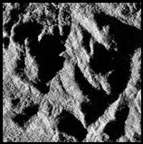
Slopes
Any slope leads to geometric distortion. Radar signals that return to the spacecraft from a mountaintop arrive earlier or at the same time as the signal from the foot of the mountain, seeming to indicate that the mountaintop and the foot of the mountain are in nearly the same place — or the mountaintop may also appear before the foot. In a SAR image with layover, the mountains look as if they have fallen over toward the sensor. Steeper angles lead to more extreme layover, where mountain tops appear to lay over their base. Layover appears bright.
Geometric distortions are corrected by doing terrain correction. ASF has terrain correction tutorials for both Sentinel-1 and ERS-1 and -2, JERS-1, and RADARSAT-1. PALSAR RTC products are available already radiometrically terrain-corrected.
Hills and other large-scale surface variations tend to appear bright on one side and dim on the other. (The side that appears bright was facing the SAR.) Where slopes are very steep, the dim side may be completely dark because no radar signal is returned at all. This is called shadow. Slope-influenced brightness is corrected by doing radiometric correction. ASF has tutorials which combine radiometric and terrain correction instructions.
Various combinations of polarizations for transmitted and received signals have a large impact on the backscattering of the signal. The right choice of polarization can help emphasize particular topographic features.
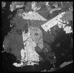
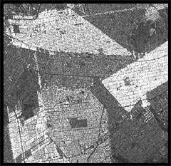
Man-Made Structures In urban areas it is at times challenging to determine the orbit direction. All buildings that are perfectly perpendicularly aligned to the flight direction show very bright returns.
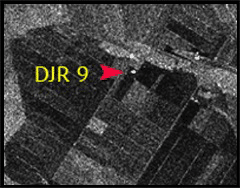
Due to the reflectivity and angular structure of buildings, bridges, and other human-made objects, these targets tend to behave as corner reflectors and show up as bright spots in a synthetic aperture radar (SAR) image. A particularly strong response — for example, from a corner reflector or ASF’s receiving antenna — can look like a bright dot or a cross in a processed synthetic aperture radar (SAR) image.
Brooklyn neighborhoods such as Bedford
-Stuyvesant with north-south running streets
show strong radar return, as the buildings are
oriented perpendicular to the imaging radar beam.