





Stay Curious
Not every radar image tells a story about earthquakes, volcanoes, or melting glaciers. Sometimes it reveals something unexpected; a striking pattern, an optical illusion, a familiar shape, or a moment that makes you stop and wonder. This collection celebrates the surprising side of SAR imagery. Some images reveal remarkable natural formations, while others highlight unusual human-made features or capture moments that have shaped communities and drawn the world’s attention. Each one invites you to pause, take a closer look, and ask a simple question: What am I looking at?
So take a closer look. Explore. Imagine. Be surprised. Whether you see science, art, or something in between, there’s always something new to discover when you stay curious.
A Diamond from Space
Location: India
Date(s): 2023
Spacecraft/Agency: Sentinel-1 / European Space Agency (ESA).
Credit: Copernicus Sentinel data 2023, processed by ESA.
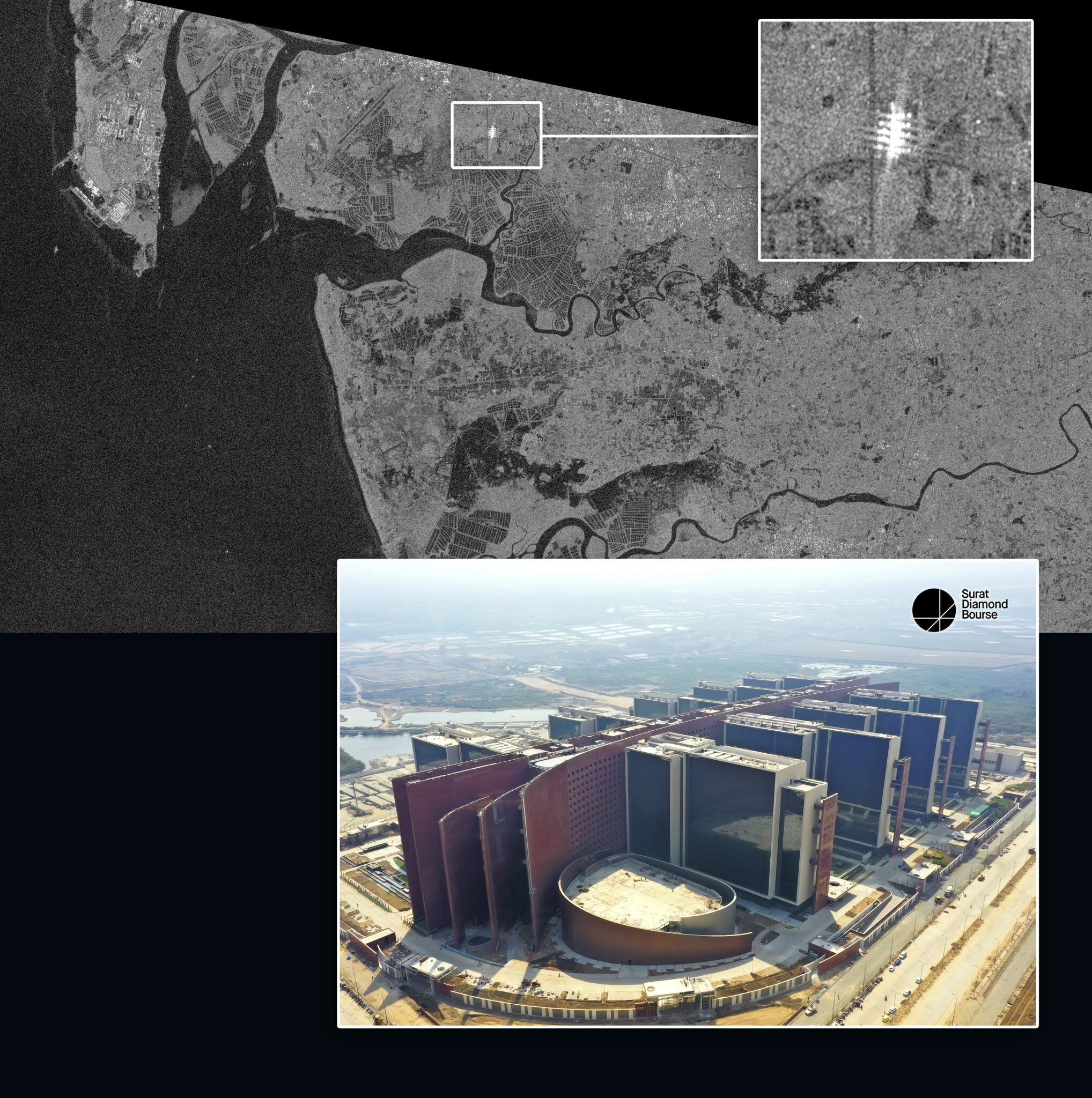
Surat Diamond Bourse is the world’s largest office building, with 660,000 m2 (7.1 million ft2) of floor space covering more than 14 hectares (35 acres). The city of Surat, India, produces 90% of the world’s processed diamonds, and the bourse (where commodities are exchanged) was built as a center for the diamond industry. The unique shape of the building, with nine rectangular structures connected by a central “spine,” provides many reflective surfaces. This creates a very bright and distinctive SAR pattern that stands out clearly from the surrounding landscape.
Ever Given
Location: Suez Canal, Middle East
Date(s): 2021
Spacecraft/Agency: Sentinel-1 / European Space Agency (ESA).
Credit: Copernicus Sentinel data 2021; courtesy R. Gens.
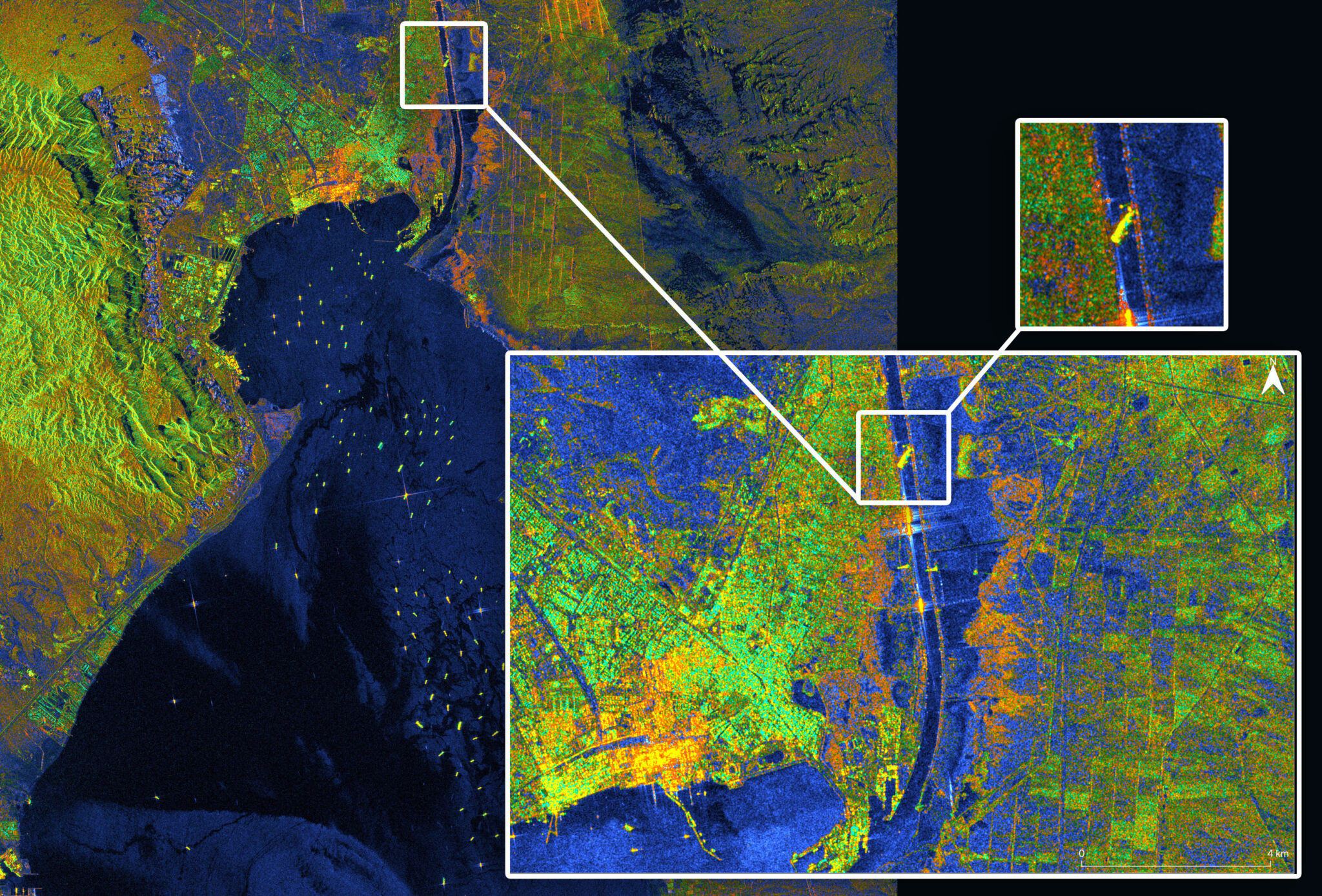
On March 23, 2021, the 400 m (1,300 ft) long container ship Ever Given, buffeted by high winds, became wedged across the Suez Canal. This completely blocked ship traffic in both directions; by March 28, at least 369 ships were waiting to pass through the canal. On March 29, the ship was partially refloated. This Sentinel-1 RGB image shows the container ship positioned in the canal and the ships in the Gulf of Suez waiting to pass. The six days the ship was stuck had a significant effect on the world economy.
Fairbanks and Fort Knox
Location: Fairbanks
Date(s): 2022
Spacecraft/Agency: UAVSAR / NASA
Credit: NASA JPL 2022
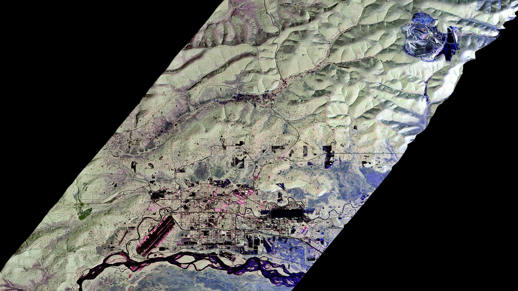
Fairbanks was founded as a trading post in 1901 to supply the stampede resulting from the discovery of gold in the area. The Fort Knox mine is located in the Fairbanks mining district and began as a small shaft mine in 1913. Construction of the open pit mine began in 1995, and today, Fort Knox is the largest gold producer in Alaska’s history. This UAVSAR Pauli decomposition image shows the open pit mine, mill, and tailings pond (upper right) 24 km (15 miles) northeast of the city of Fairbanks and the Tanana River (at bottom).
Feature Emphasis
Location: North Slope
Date(s): 2004
Spacecraft/Agency: AIRSAR/ NASA.
Credit: NASA JPL 2004.
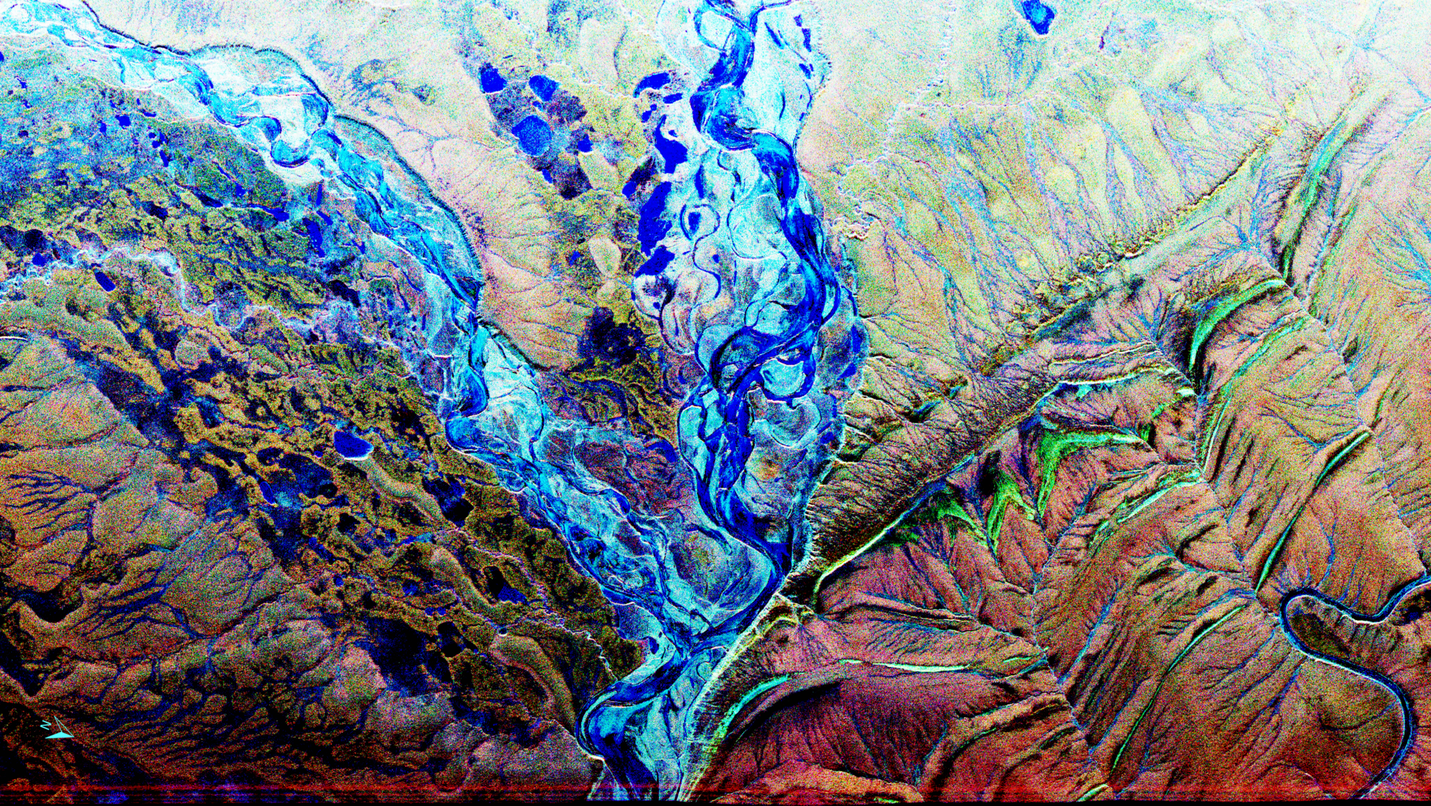
The Airborne Synthetic Aperture Radar (AIRSAR) project was run by JPL from 1988-2004. The project successfully demonstrated new radar technology and led to the development of new radar imaging applications and processing techniques. The airborne platform incorporated three SAR instruments with different radar wavelengths. This TOPSAR image of the Awuna River on the north slope of Alaska is an overlay of P-band (RED), L-band (GREEN), and C-band (BLUE) radar backscatter and demonstrates how sensor wavelength can be used to emphasize different features of a landscape.
Serpentine
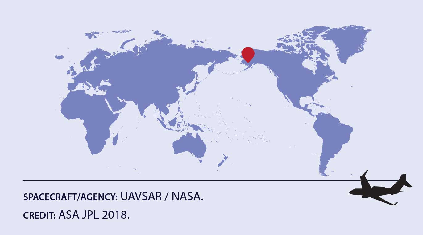
Location: Southwest Alaska
Date(s): 2018
Spacecraft/Agency: UAVSAR / NASA.
Credit: NASA JPL 2018.
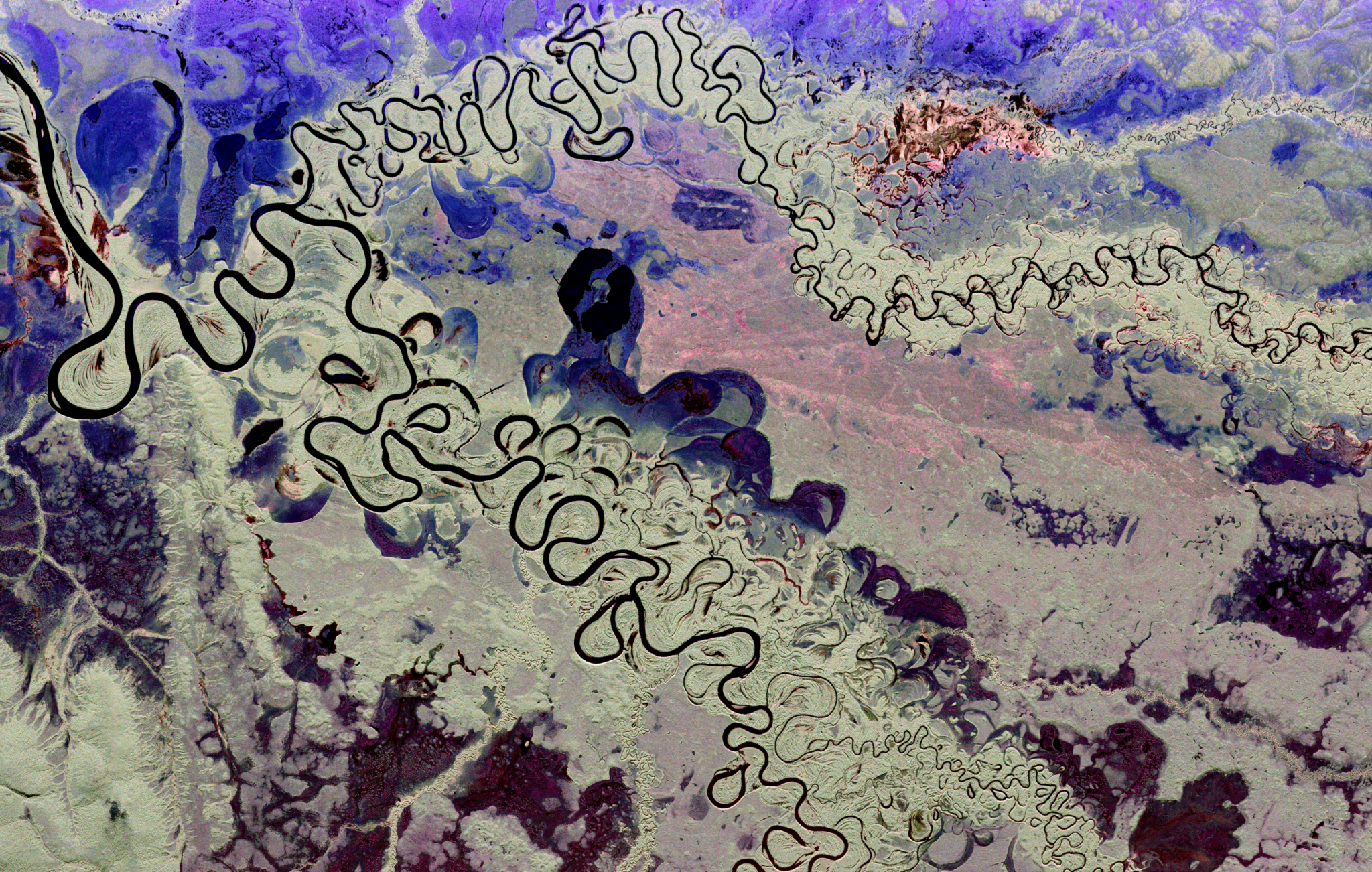
In this UAVSAR Pauli decomposition, the Holitna River runs through the center of the image. The river is located in southwest Alaska and is the largest river system in the Kuskokwim River basin. The Hoholitna River, seen at the top of the image, is a major tributary and joins the Holitna 32(20 miles) from the Kuskokwim River. The flat landscape accounts for the extreme serpentine nature of the rivers and the formation of oxbow lakes – U-shaped lakes that form when a meander of a river is cut-off. Many of these lakes are visible here.