Please ensure Javascript is enabled for purposes of website accessibility
ASF Logo
North American Space Agency (NASA) Logo
  • Home
  • Get Started
        • Data

          • Data Overview
          • Get an Account. Find Data.
          • Datasets Available from ASF DAAC
          • How to Use SAR Data (Data Recipes)
          • SAR Data and GIS
          • Types of Synthetic Aperture Radar (SAR) Products at ASF
          • ASF Datasets – Formats and Files
        • Resources

          • Resources Overview
          • How to Credit Data Use
          • SAR FAQ
          • Fundamentals of SAR Media Resources
          • Vertex Help
          • Site Map
        • Tools

          • Tools Overview
          • Sentinel-1 RTC Stack Processor
          • Sentinel-1 ArcGIS Tools
          • ASF MapReady
          • ASF Bulk Data Download Options
          • Convert to Vector
          • Third Party Tools
          • ASF Software License Agreement
  • Get Data
        • Get Data at ASF DAAC

          • ASF Vertex (opens in a new tab)
          • ASF Search API
          • ASF Custom SAR Processing
          • ASF Baseline Tool (opens in a new tab)
          • RADARSAT-1 and JERS-1 Restricted Data Acess
        • Data Use

          • Citation Policy
          • End User License Agreement (EULA)
          • Restricted Data Access Request
          • Contact Us
        • ASF Data Search – Vertex

          Screenshot of the Vertex Interface
  • SAR Datasets
        • SAR Datasets

          • SAR Datasets Overview
          • ALOS PALSAR
          • Sentinel-1
          • AIRSAR
          • ERS-1
          • ERS-2
          • JERS-1
          • RADARSAT-1
          • Seasat
          • Soil Moisture Active Passive (SMAP) Mission
          • UAVSAR
        • Derived Datasets

          • ALOS PALSAR – Radiometric Terrain Correction
          • Global Ice Sheet Mapping Orbiter (GISMO)
          • Glacier Speed
          • InSAR
          • International Polar Year 2007-2008
          • Radarsat Antarctic Mapping Project (RAMP)
          • Sea Ice MEaSUREs
          • Sentinel-1 Interferograms
          • Sentinel-1 Interferometric Coherence and Backscatter
          • Terrestrial Ecology
          • Wetlands MEaSUREs
        • Optical Datasets

          • ALOS AVNIR-2 Ortho Rectified Image Product
        • ASF Dataset DOI’s

          • ASF Dataset DOIs
  • About SAR
        • SAR Information

          • Data Formats Explained
          • PALSAR RTC DEM Information
          • Image Interpretation
          • SAR Basics
          • SAR FAQ
          • SAR & InSAR Guides
        • SAR Training

          • SAR Data Recipes (Tutorials)
        • Glacier Power

          • Glacier Power
        • ASF Data Terms of Use

          • Citation Policy
          • End User License Agreement (EULA)
          • Restricted Data Access Request
          • Contact Us
  • About ASF
        • UAF Logo

          Alaska Satellite Facility: Making remote-sensing data accessible.


        • The Alaska Satellite Facility

          • About ASF
          • ASF DAAC
          • SAR Scientist Highlights
          • ASF News & Notes Archive
        • Blue satellite dish antenna that sits atop the Elvey Building at the University of Alaska Fairbanks
  • Contact

HomeData Recipes

Posts in category: Data Recipes

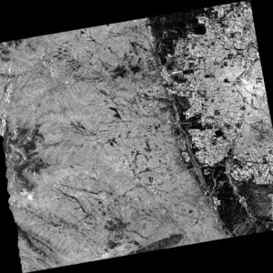
Generating a Radiometrically Terrain Corrected (RTC) Image using the Sentinel-1 Toolbox (S1TBX) Version 8

This data recipe is for users who wish to generate an RTC image from Sentinel-1 data using easy-to-follow instructions in a graphical user interface (GUI)….

Read More
subsetting

How to Acquire and Subset Sentinel-1 InSAR Data with Harmony and the GDAL Subsetter

This recipe goes through the basic steps of constructing a Harmony request URL to find S1 InSAR data that falls within an area and time period of interest and perform variable and spatial subsetting on the data using the GDAL Subsetter….

Read More
title2-deplacement-map

Unwrapped Interferograms: Creating a Deformation Map

Learn how to convert the phase values in an unwrapped interferogram to vertical displacement units (meters) in this ASF data recipe….

Read More
Create bucket

How to Create Cloud Storage Using AWS Simple Storage Service (S3)

Learn more about creating cloud storage using the Simple Storage Service (S3) in this Alaska Satellite Facility Data Recipe….

Read More
ASF Standardized InSAR Processing Flow.

Data Recipes — Further Reading

Learn more and find extended references in a variety of topics related to ASF’s Data Recipes to expand your SAR knowledge….

Read More
Animation of inundation in Amazon rain forest. Credit: Chapman, Guritz 2016; RTC: ASF 2015; Includes Material © JAXA/METI 2007.

Mapear la Inundación Regional con SAR de banda L por el Espacio

Esta receta de datos de dos partes es para los usuarios quienes quieren mapear la inundaciónregional con el Radar de Apertura Sintética de banda L….

Read More
Script output images: color phase products for each swath F1, F2, F3. Contains modified Copernicus Sentinel data (2015) processed by ESA.

How to Configure AWS for Running the GMT5SAR InSAR Recipe

Learn how to use an AWS EC2 instance to run the GMT5SAR InSAR data recipe….

Read More
Animation of inundation in Amazon rain forest. Credit: Chapman, Guritz 2016; RTC: ASF 2015; Includes Material © JAXA/METI 2007.

How to Map Regional Inundation with Spaceborne L-band SAR using ArcGIS

Learn more about mapping regional inundation using spaceborne L-band SAR data and ArcGIS with this Alaska Satellite Facility Data Recipe….

Read More
cloud-recipe-image-5

How to Move files in and out of an AWS EC2 Instance – Windows

Learn more about moving files in and out of an AWS Elastic Compute Cloud instance on Windows with this Alaska Satellite Facility Data Recipe….

Read More
The unwrapped phase image above of the 2016 Kumamoto Earthquake shows displacement clearly after multi-looking and phase filtering were applied. Contains modified Copernicus Sentinel data 2016, processed by ESA.

How to Phase Unwrap an Interferogram

Learn more about phase unwrapping interferograms using the European Space Agency’s Sentinel-1 Toolbox with this Alaska Satellite Facility Data Recipe….

Read More
  • 1
  • 2
  • 3
  • ...
  • 5
  • Next
  • Last

Header images provided by

About Us

The Alaska Satellite Facility downlinks, processes, archives, and distributes remote-sensing data to scientific users around the world. ASF’s mission is to make remote-sensing data accessible.
Read More

Contact Info

Alaska Satellite Facility
2156 Koyukuk Drive
Fairbanks, AK 99775
(907) 474-5041
uso@asf.alaska.edu
Send us a Message
© 2022 ASF. UA is an AA/EO employer and educational institution and prohibits illegal discrimination against any individual. | Web Privacy Policy | Site Map |
Shopping Basket

URS Login

Lost your password?