

Coverage Maps
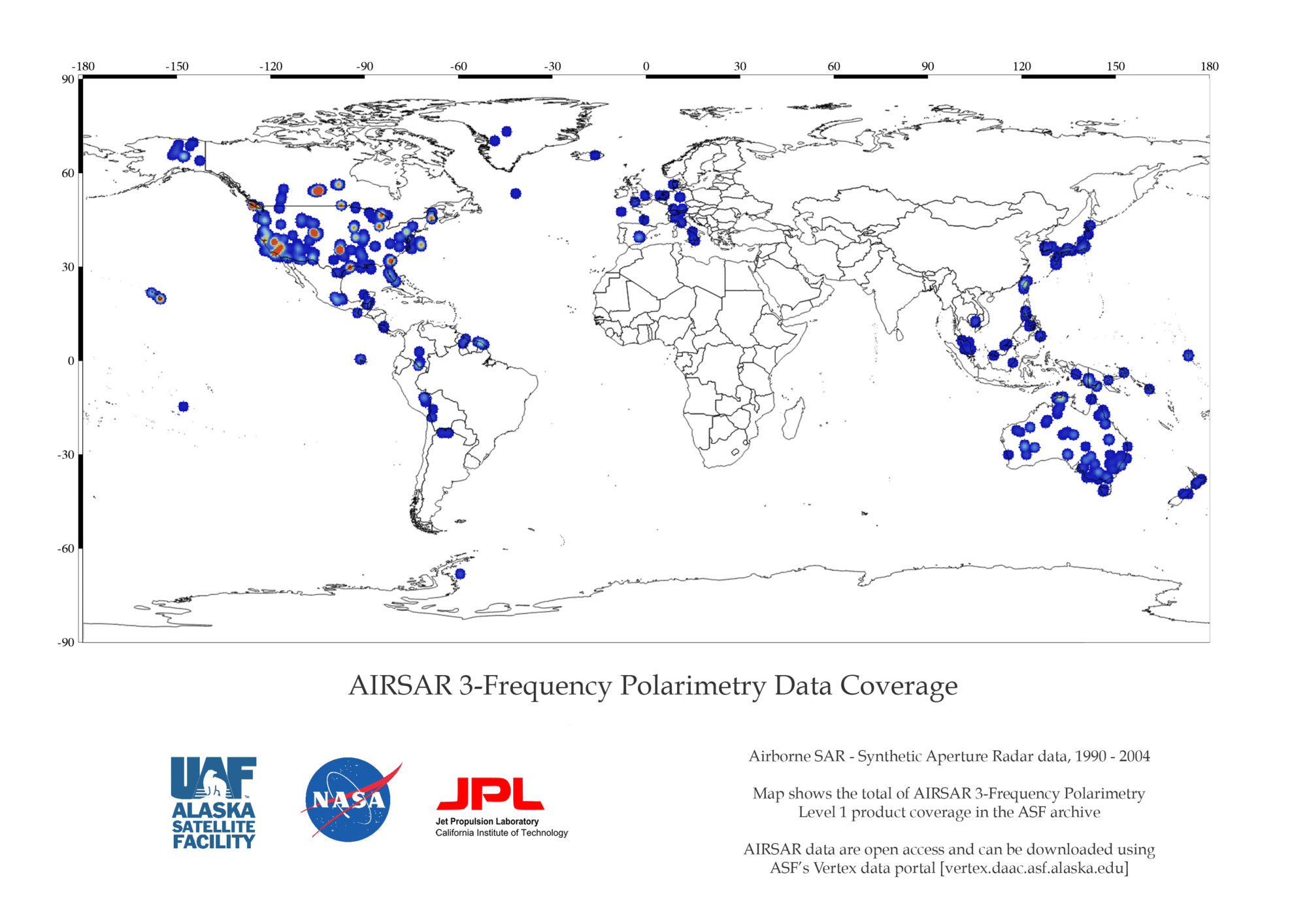
AIRSAR 3FP Coverage Map
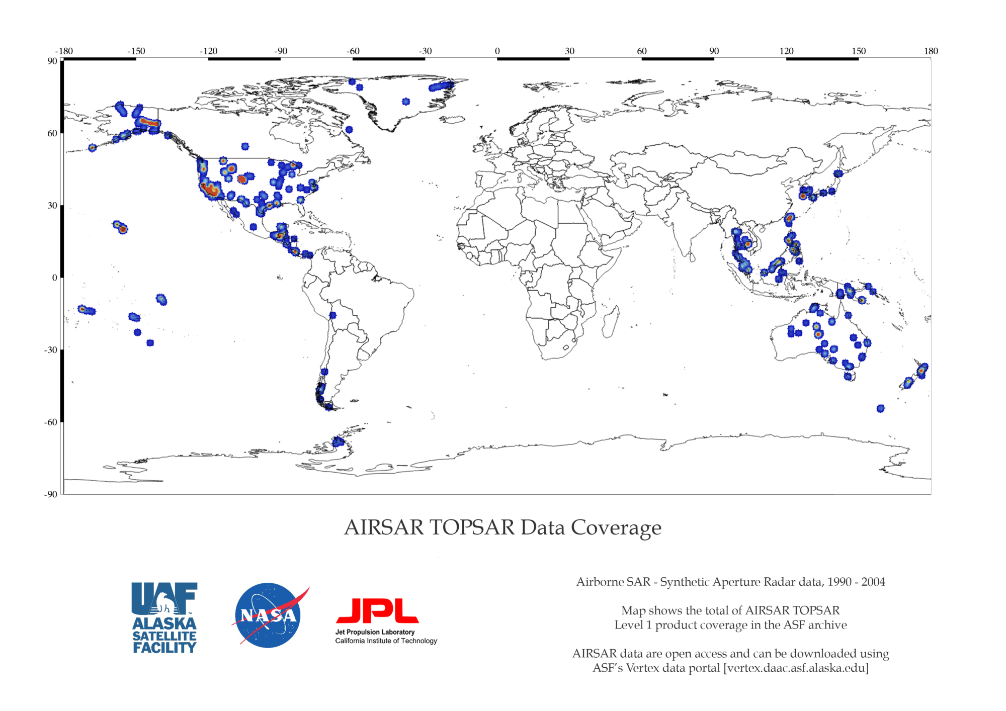
AIRSAR DEM Coverage Map
AIRSAR Aircraft and sensor
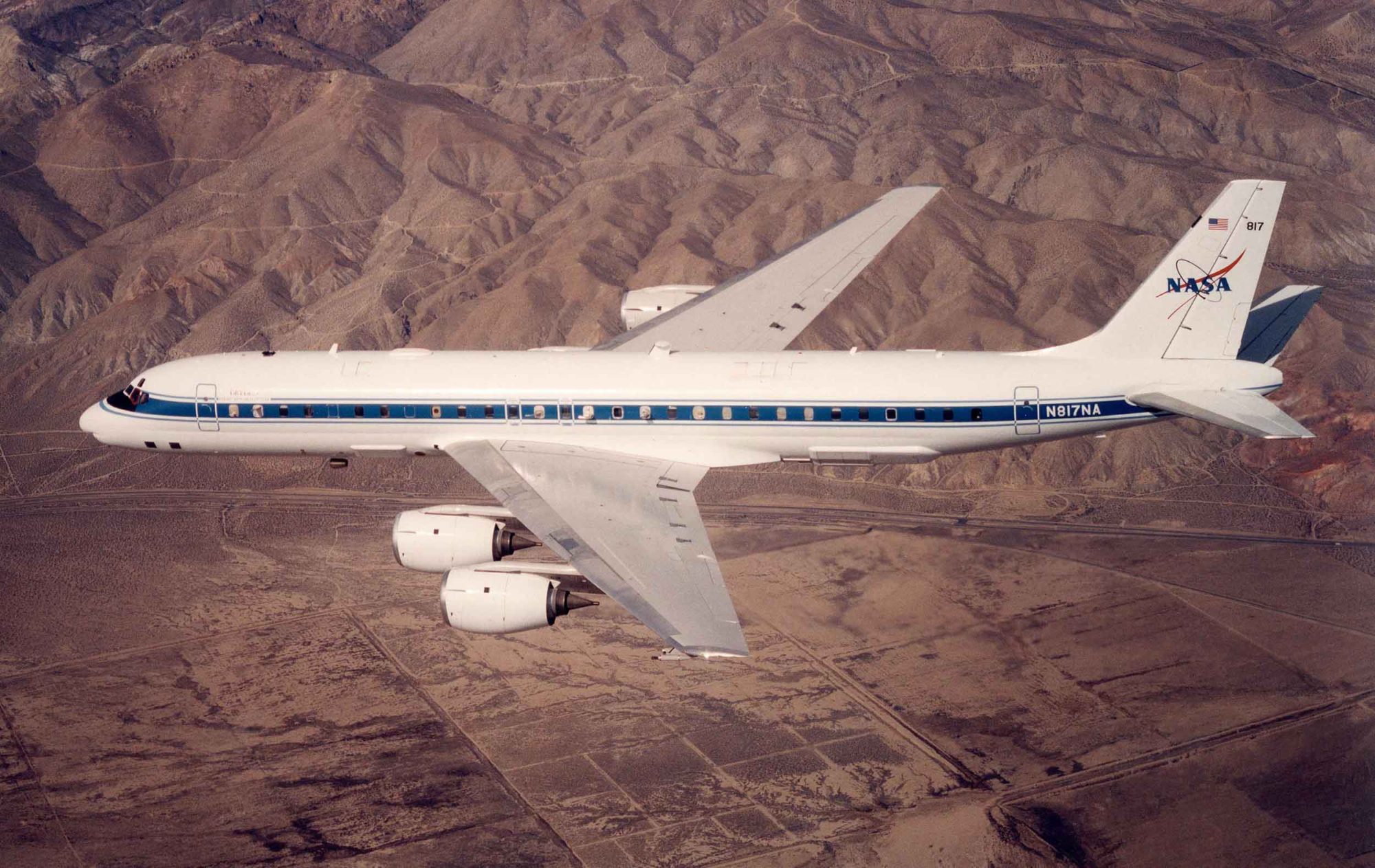
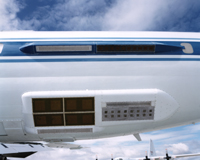
The AIRSAR instrument (panels behind wing) are mounted aboard a modified NASA DC-8 aircraft. During data collection, the plane flies at 8 kilometers over the average terrain height at a velocity of 215 meters per second.
The AIRSAR radar antennas are mounted on the back part of the DC-8 aircraft. These antennas are used to collect data in all three modes. L-band ATI uses an additional antenna (not shown) located in front of the wings.
See the Product Information tab for details.
AIRSAR Datasets and DOIs
| Dataset | DOI |
|---|---|
| AirSAR_TOPSAR | 10.5067/F1SC87EFGT9U |